While the threat of severe weather will diminish, the threat of flooding rains will increase in the eastern United States later today into tomorrow and Friday, with heavy, flooding rains expected in the Mid Atlantic once again.
Periods of heavy rain will begin over western portions of the Mid Atlantic early Thursday and slide east throughout the day. By late Thursday afternoon and into Thursday evening, the heavy rain will arrive to the I-95 corridor between Washington, DC and New York City, NY. Rainfall will decrease in intensity Friday morning but impacts from the earlier heavier rainfall may linger into the day on Friday.
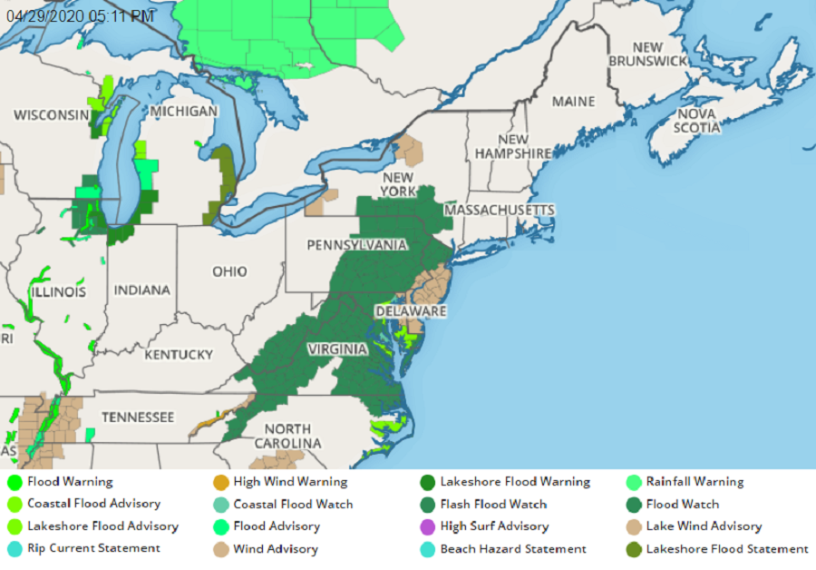
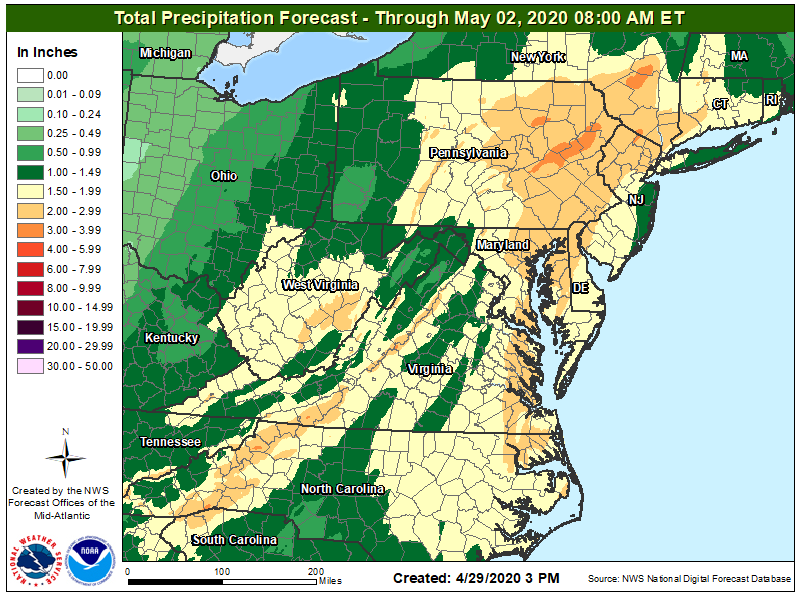
With widespread heavy rains expected, the National Weather Service has issued Flood Watches across a large area. Rainfall amounts will generally range from 1.5to 2.5 inches over the watch area, however locally higher amounts will be possible particularly over the higher terrain of eastern Pennsylvania and northwest New Jersey. There, rain in excess of 3″ may fall. As a result of the rainfall, poor drainage and low-lying flooding may begin late Thursday. Small stream as well as mainstem flooding is possible Thursday night into Friday. A Flood Watch means there is a potential for flooding based on current forecasts. The National Weather Service recommends people in a Flood Watch to be alert for possible Flood Warnings. Those living in areas prone to flooding should be prepared to take action should flooding develop.
The low pressure system responsible for the rain will be slow to pull out; as such, cloudy skies and scattered rain showers will linger into Saturday in the northeast. More unsettled weather is expected early next week as another storm moves through in an active weather pattern.
