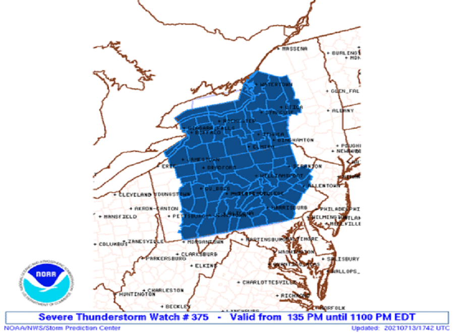
After a day of epic rains in Pennsylvania and New Jersey and tornado warnings in Pennsylvania, New Jersey, and New York, it appears yet another round of bad weather will strike: flooding rains and severe thunderstorms with damaging wind gusts, large hail, and isolated tornadoes are returning today to portions of the northeast. With more severe weather arriving, the National Weather Service has issued a Severe Thunderstorm Watch in effect through 11pm tonight for western upstate New York and much of Pennsylvania; additional watches and warnings could be issued later today.
In addition to heavy rain and severe storms, another day of dangerously hot weather is expected. In the urban corridor around the Philadelphia metro area and the eastern shores of Maryland, the National Weather Service has raised a Heat Advisory there through 8 pm tonight with heat index values up to 102 expected. The combination of high temperatures and high humidity levels may cause heat illnesses to occur. The National Weather Service advises, “Drink plenty of fluids, stay in an air-conditioned room, stay out of the sun, and check up on relatives and neighbors. Young children and pets should never be left unattended in vehicles under any circumstances.”
Portions of New Jersey and Pennsylvania saw 6-10″ of rain within a 3-4 hour period yesterday, creating epic flooding that prompted water rescues around Bensalem, Croydon, Bristol, and Florence. The National Weather Service says the storm is estimated to be a 100 year flood event. Unfortunately, new pop-up storms and showers could form here later today, creating additional headaches for those cleaning up from yesterday’s floods.
Today, a warm front extends through eastern New York into Ontario, while a cold front stretches from a surface low near Lake Michigan southward through eastern Illinois. The most unstable portion of the warm sector is expected to evolve from Pennsylvania through western and central New York where ample boundary layer heating is already occurring within a boundary layer characterized by exceptionally high dewpoints. This environment will support both multicells and possibly some supercell structures, evolving into storm lines and clusters with time as convection develops in the weakly capped warm sector. Isolated damaging wind and some hail will be the main threats in the northeast, according to the National Weather Service; they also say a tornado or two are also possible, especially with storms interacting with warm front in portions of Pennsylvania and New York.
