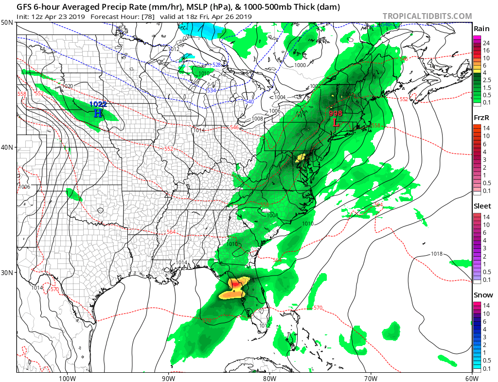
While more rain is returning to the eastern United States for the end of the week, it appears severe weather won’t be as widespread as it has been over the last two weeks. While there is at least a slight chance for severe weather near the coast of the Gulf of Mexico this week, the threat should remain isolated to a small part of the southeast in the coming days. While the severe weather will be restricted, the soggy weather won’t.
Low pressure moving across the country is responsible for this round of rainfall. Rain and thunder showers will stretch from Florida north to Maine by Friday afternoon. The best chance of thunderstorms will be from New York City and south, although an isolated storm can’t be ruled out elsewhere in New England. However, severe storms, those with damaging winds, large hail, and/or tornadoes, would be limited to northern Florida then. Unlike severe weather outbreaks of recent weeks, there won’t be enough energy or moisture to create a wider severe weather threat into the Great Lakes and New England areas.
On Saturday, high pressure will return. While a couple of showers or sprinkles may form in Upstate New York and the Poconos Sunday afternoon, much of the northeast and southeast should be dry. Temperatures should also be at near-normal levels from north to south, making for a pleasant, quiet, typical spring weather weekend.