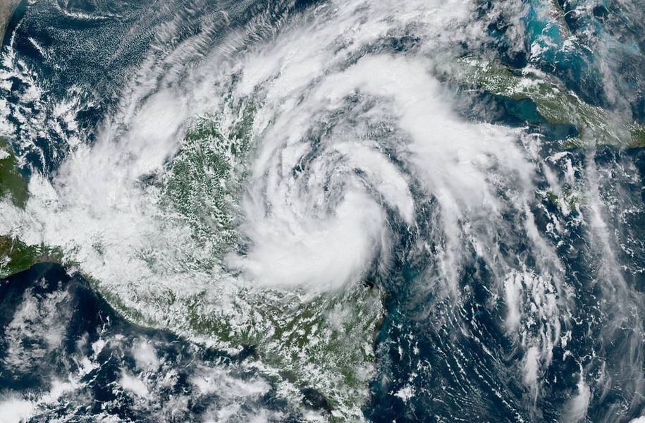
A new tropical depression has formed in the northwestern Caribbean Sea; over time, it is expected to become a tropical storm and be named Gamma. Ahead of the storm, watches and warnings have been posted.
Known officially as Tropical Depression #25, the system is located about 200 miles southeast of Cozumel, Mexico. According to the 2pm ET update from the National Hurricane Center, the system was moving toward the northwest at 8 mph with a gradual turn toward the north-northwest and a decrease in forward speed expected over the next few days.
Based on the latest forecast track from the National Hurricane Center, the center of the tropical cyclone should be near the northeastern Yucatan Peninsula on Saturday. At that time, it should strengthen to a tropical storm, earning it the name “Gamma.”
Beyond the Yucatan, the latest forecast has the storm making a sharp left turn over open waters of the Gulf. Until such a change in direction occurs, people throughout the entire Gulf coast should monitor this system and its future progress this weekend.
For now, a Tropical Storm Warning is in effect for Punta Herrero to Cabo Catoche, Mexico. Tropical storm conditions are expected there by early Saturday. A Tropical Storm Watch is in effect from south of Punta Herrero to Puerto Costa Maya and west of Cabo Catoche to Dzilam. Topical storm conditions are possible there on Saturday and Sunday.
This storm is expected to produce rainfall of 4-8″, with isolated maximum amounts of 12″, in portions of the Yucatan Peninsula and far western Cuba. A separate area of significant rain is expected to develop well away from the center in the Mexican states of Campeche, Tabasco, and northern Chiapas, with rainfall of 8-12″ and isolated maximum amounts of 20″. Such heavy rainfall could produce life-threatening flash floods and mudslides.
