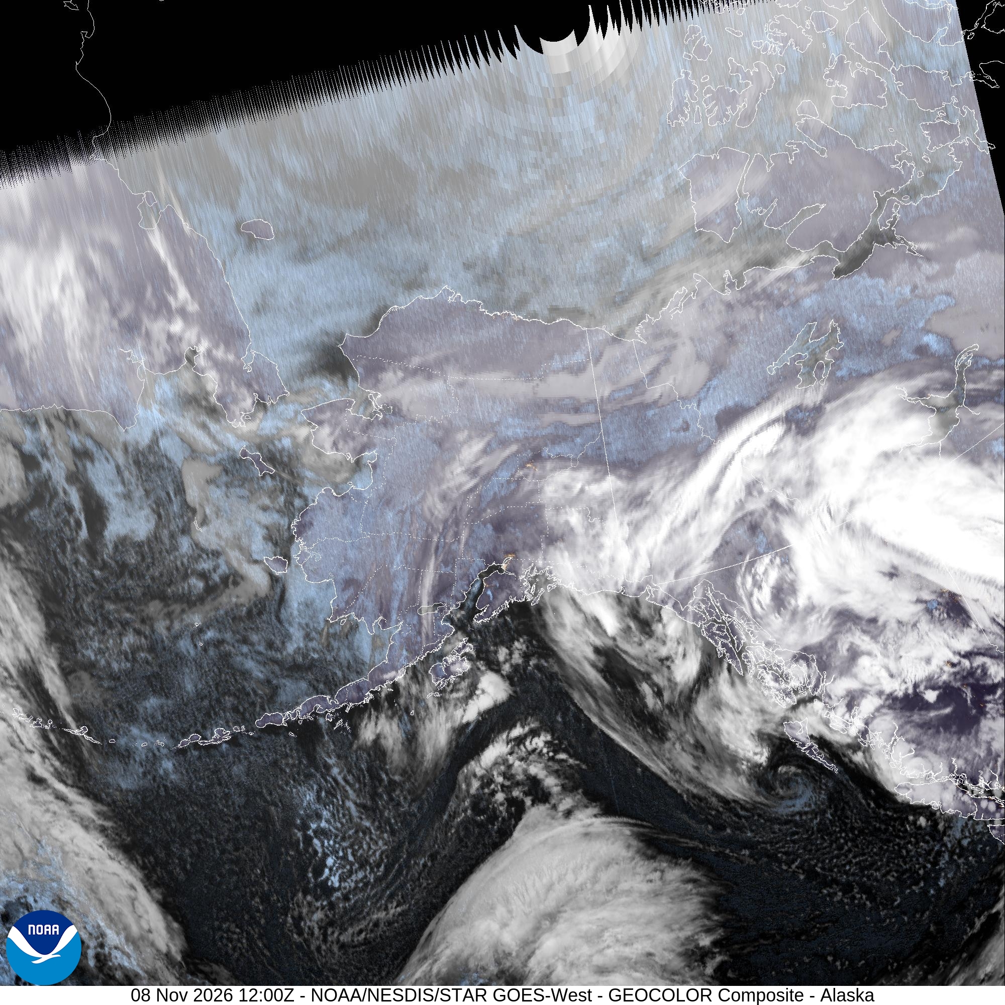
A powerful North Pacific storm moving into the Gulf of Alaska on Monday is expected to bring heavy snow, a wintry mix and damaging easterly winds to Turnagain Arm, the Kenai Peninsula and western Prince William Sound, prompting the National Weather Service to post a Winter Storm Watch from Monday morning through Tuesday afternoon.
The weather service office in Anchorage first issued the watch at 10:13 p.m. AKST Saturday and updated it at 12:20 a.m. AKST Sunday. It covers the forecast zones for East Turnagain Arm, Portage, the Southern Kenai Mountains, the Interior Kenai Peninsula, Turnagain Pass and West Prince William Sound and Whittier, including Whittier, Moose Pass, Seward, Girdwood, Turnagain Pass, Portage, Hope, Summit Lake and Chenega. The watch runs until 4 p.m. AKST Tuesday.
“Travel could be very difficult,” the weather service said in the watch. “The hazardous conditions could impact the Monday evening and Tuesday morning commutes. Very strong winds could cause extensive damage to trees and power lines.”
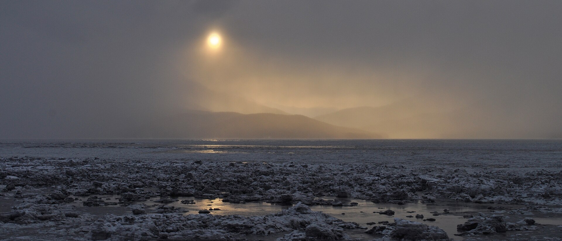
Snow, Ice and Wind Along the Seward Highway Corridor
Forecasters said total snow accumulations of 3 to 7 inches are possible for Whittier, eastern Turnagain Arm, Girdwood and from Moose Pass to north of Seward. The heaviest totals, 5 to 10 inches, are possible from Turnagain Pass to Tern Lake, including the Hope Cutoff.
Ice is also a concern. The watch calls for a light glaze of ice possible from Turnagain Pass to Tern Lake and up to one-tenth of an inch from the Hope Cutoff to Hope.
The wind threat is focused on eastern Turnagain Arm, where the weather service said easterly winds of 55 to 70 mph are possible Tuesday morning. The watch said the easterly winds through Whittier and eastern Turnagain Arm “may peak around 60 and 70 mph before diminishing Tuesday afternoon.”
The weather service described the setup as “a strong and complex weather system” expected to move over the Kenai Peninsula beginning Monday morning. Light snow is forecast to become steady by late Monday afternoon, with snow, heavy at times, Monday night through early Tuesday morning.
East winds from Prince William Sound are expected to push through Whittier and across eastern Turnagain Arm, “quickly changing the snow at lower elevations to rain,” the watch said. At higher elevations, the snow may turn into a wintry mix of snow, sleet and freezing rain before changing to rain. Forecasters added that rain could lead to slush and ponding of water on roads.
What the Zone Forecasts Show
The weather service’s zone forecasts issued at 2:47 a.m. AKST Sunday add detail for individual communities. For eastern Turnagain Arm, including Girdwood, the forecast calls for snow Monday afternoon with 2 to 3 inches of accumulation, then rain and snow after midnight with east winds of 15 to 30 mph and gusts to 65 mph. Rain and snow Tuesday morning are forecast to turn to rain in the afternoon, with highs in the upper 30s to mid-40s.
In Portage, the forecast calls for 2 to 5 inches of snow Monday and east winds Monday night gusting to 70 mph, with rain and gusts to 70 mph continuing Tuesday before winds decrease in the afternoon.
The zone forecast for western Prince William Sound and Whittier calls for rain and snow Monday, heavy at times in the afternoon, with up to 5 inches of snow and a snow level of 700 feet. North winds of 25 to 40 mph are forecast to gust to 55 mph, increasing to 75 mph in the afternoon, followed by east winds of 35 to 50 mph and gusts to 75 mph Monday night.
At Turnagain Pass, forecasters expect 1 to 6 inches of snow Monday, then snow and rain after midnight with gusts to 65 mph. For the Interior Kenai Peninsula, including Moose Pass, Summit Lake and Hope, the forecast calls for snow and freezing rain after midnight Monday and gusts to 65 mph.
Thompson Pass and Ernestine also Under Watches
The same storm prompted separate Winter Storm Watches farther east in the Anchorage forecast area. For Thompson Pass, the weather service said blizzard conditions are possible from Monday morning through Tuesday afternoon, with 6 to 12 inches of snow, wind gusts as high as 45 mph and visibility as low as one-quarter mile in blowing snow.
For the Ernestine zone, which includes Tonsina and 46 Mile, forecasters said 3 to 12 inches of snow and ice accumulations from a light glaze to a few hundredths of an inch are possible from Monday morning through Tuesday morning. The highest totals are expected toward the north side of Thompson Pass.
The Storm Behind the Watch
In its area forecast discussion issued at 3:49 p.m. AKST Saturday, the weather service said a North Pacific low will move into the Gulf of Alaska on Monday, “bringing gale to storm force winds to the Northern Gulf with coastal rain and inland snow.”
Forecasters said warmer air will move into the higher elevations Monday, changing snow to a rain-snow mix by the afternoon. As the low moves toward southcentral Alaska, wind gusts are expected to increase and remain gusty “in the usual gap locations of Southcentral.” The discussion said model agreement continues that Kodiak Island, the eastern Kenai Peninsula and Prince William Sound will see the heaviest precipitation Monday and Tuesday.
Storm Warnings for the Northern Gulf
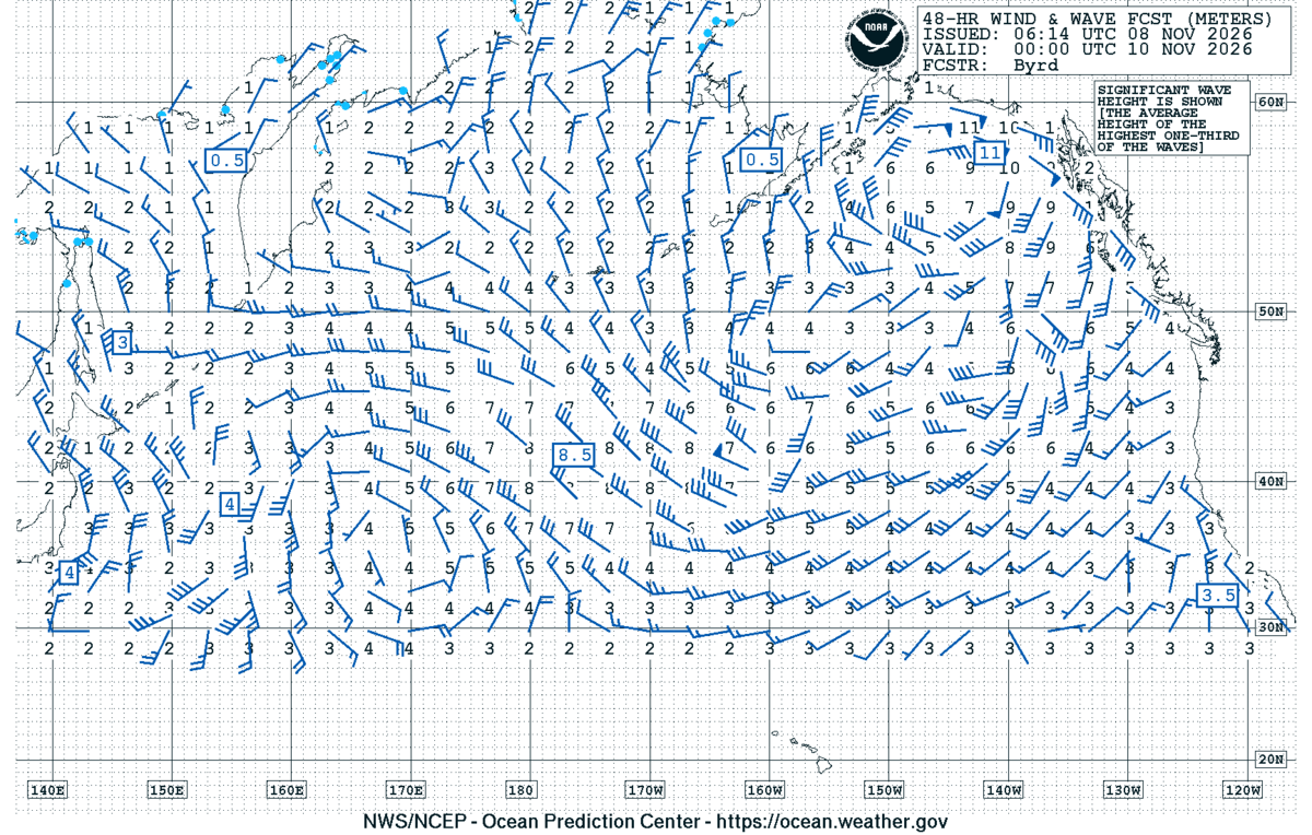
The marine forecast is the starkest sign of the storm’s strength. In its coastal and offshore waters forecasts issued at 3:09 a.m. AKST Sunday, the weather service posted Storm Warnings for Monday on several northern Gulf zones.
From Cape Suckling to Cape Cleare, 15 to 75 nautical miles offshore, forecasters expect east winds of 55 knots, or about 63 mph, Monday, with seas of 22 feet building to 31 feet and isolated afternoon thunderstorms. Monday night, southeast winds of 55 knots and 33-foot seas are forecast.
Closer to shore, from Cape Suckling to Gravel Point out to 15 nautical miles, northeast winds of 35 knots are forecast to become east at 50 knots Monday afternoon, with seas building from 12 to 24 feet. Monday night, east winds of 55 knots and 32-foot seas are expected.
Storm Warnings are also posted from Cape Cleare to Gore Point, 15 to 75 nautical miles out, where northeast winds of 50 knots and seas of 17 to 25 feet are forecast Monday, and from Gore Point to Marmot Island, 15 to 80 nautical miles out, with northeast winds of 50 knots and seas building from 16 to 23 feet. Over the offshore Gulf north of 57 degrees north and west of 144 degrees west, the forecast calls for east winds of 35 to 50 knots Monday and seas of 15 to 28 feet.
Inside waters face Gale Warnings. Southwest Prince William Sound is forecast to see northeast winds of 35 knots and 7-foot seas with rain and snow Monday, then east winds of 45 knots Monday night. In Cook Inlet from Kalgin Island to Point Bede, northeast winds of 40 knots and 10-foot seas are forecast Monday.
The National Weather Service office in Juneau also has Storm Warnings for the eastern Gulf, reflecting the size of the same system.
What Comes Next
The watch could be upgraded or adjusted as the storm nears. For now, the weather service urged residents to “monitor the latest forecasts for updates on this situation.”
Forecasters expect winds through Whittier and eastern Turnagain Arm to diminish Tuesday afternoon. The longer-range discussion said lingering light rain and snow are possible along the coast Wednesday, with another low bringing wind and rain to southcentral Alaska by Thursday.
