A tropical cyclone threat persists in the Gulf of Mexico, with experts at the National Hurricane Center closely monitoring the region for any signs of tropical cyclone formation.
Disorganized showers and thunderstorms over portions of the Gulf of Mexico are associated with a surface trough for now. According to the National Hurricane Center, a broad area of low pressure is likely to develop over the Gulf of Mexico this weekend or early next week, but subsequent tropical or subtropical development could be limited by the system’s potential interaction with a frontal boundary.
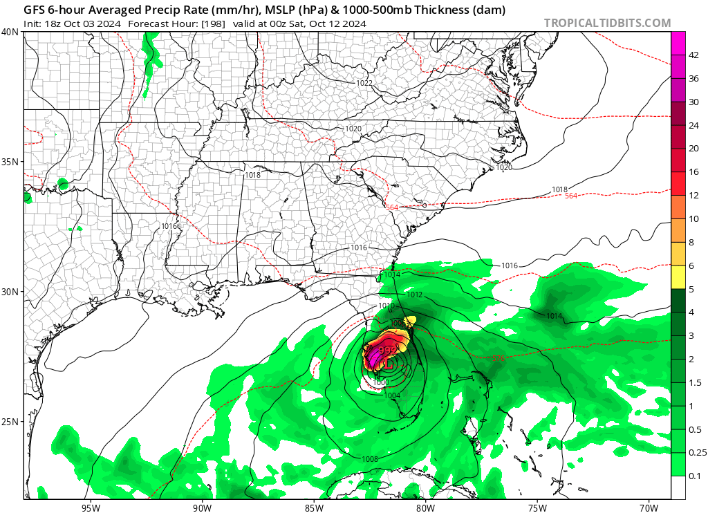
However, computer forecast models, including global models ECMWF, GFS, and ICON are all suggesting that a tropical cyclone will form next week and eventually impact Florida by the end of the week. It is too soon to know whether or not such a scenario will actually unfold, especially with the National Hurricane Center expressing concern about the possible frontal boundary interaction.
Nevertheless, regardless of development, locally heavy rains could occur over portions of Mexico during the next few days and over portions of the Florida Peninsula from late this weekend into next week. Some of these rains could fall on areas hit hard by Hurricane Helene last week.
