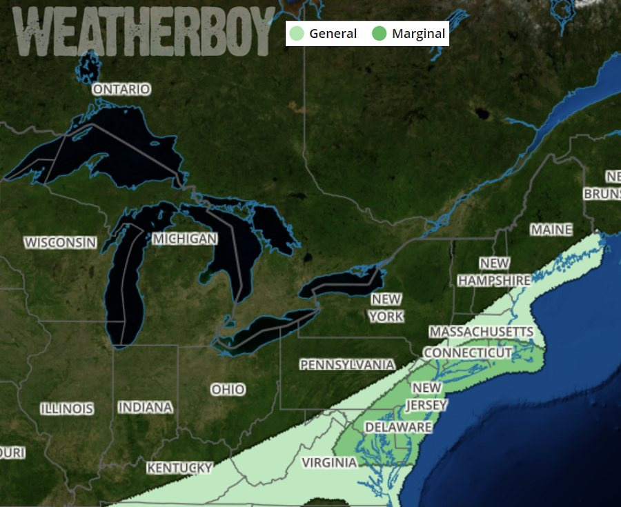
Some gusty storms are possible in portions of the Mid Atlantic tonight, with the best threat of wind damage between 8pm and 2am tonight. While storms could contain severe winds, the chances for damaging hail and tornadoes is very low.
The gusty winds are tied to a frontal system swinging through the region this evening. A strong upper-level trough will slide eastward from the Great Lakes and across Ontario and Quebec, Canada through tonight. This will drive a deepening surface low eastward as it tracks through New England. An associated surface cold front will sweep through the Mid Atlantic later tonight. Some showers will move across parts of the Mid Atlantic and Northeast this evening well ahead of the cold front. These should be on the lighter side. As this weather feature slides eastward, an increase in the wind fields are forecast. As the flow, initially southwesterly, increases and transports warmer and more humid air northward, some instability is forecast to develop through the evening into the overnight hours. Some of the computer forecast guidance meteorologists use to assist in their forecasting shows a line of showers organizing eastward in the Mid Atlantic later this evening. There is a narrow line forming in western Pennsylvania now and this will be the feature to watch tonight. It is not all that clear how much lightning will be generated given the low instability forecast, however if the line is organized enough locally strong to damaging winds could occur briefly as the line moves through given the amount of wind above the surface.
While the greatest potential for wind damage is between 8pm and 2am tonight, impacts will be generally localized. The greatest threat will be near the I-95 corridor and points east, north and east of Washington, DC and south and west of Boston, MA.
Once this system moves through, conditions will settle down in time for the morning commute. High pressure at the surface centered in the Ohio Valley is forecast to gradually extend into the Mid Atlantic. A northwesterly breeze will turn west or west- southwest during the afternoon keeping conditions fair and dry.
