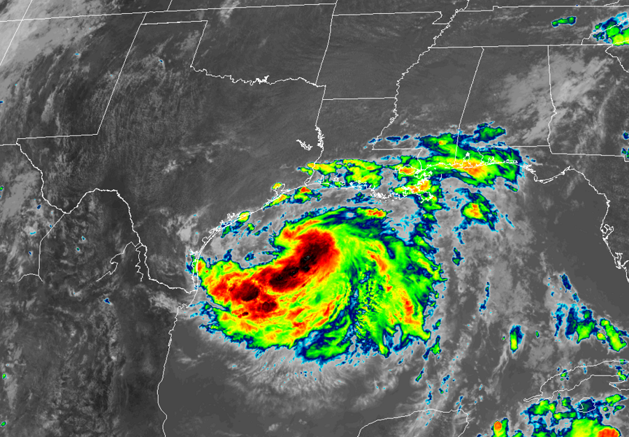
Tropical Storm Hanna continues to become better organized over the Gulf of Mexico, gaining strength before it’s expected eventual rendezvous with the Texas coastline. Hanna is expected to be a strong tropical storm when it strikes the Gulf coast, but it growing to a low-end Category 1 hurricane cannot be ruled out.
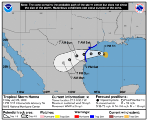
Hanna is currently located about 230 miles east of Corpus Christi and Port Mansfield in Texas. Maximum sustained winds are now up to 50 mph as the storm marches to the west north west at 9 mph.

With the storm arriving, a Tropical Storm Warning is in effect for the Texas coastline from the mouth of the Rio Grande to San Luis Pass, Texas. A Tropical Storm Warning means that tropical storm conditions are expected somewhere within the warning area, in this case within 24 to 36 hours. The National Hurricane Center urges interests along the Texas and Louisiana coast to closely monitor the progress of this system.
The National Hurricane Center expects Hanna to make a turn toward the west tonight, followed by a westward to west-southwestward motion through the weekend. On the forecast track, center of Hanna should make landfall along the Texas coast within the warning area Saturday afternoon or evening. Additional strengthening is expected until the tropical cyclone makes landfall. Once Hanna moves inland, steady weakening is expected

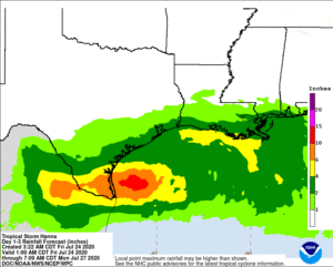
Hanna is expected to bring strong winds, heavy rain, and storm surge to Texas. Tropical storm force wind conditions are expected in the warning area by tonight or Saturday morning. 4-8″ of rain with isolated totals of around a foot are possible through Sunday night in south Texas. This rain may result in life-threatening flash flooding, rapid rises on small streams, and isolated minor to moderate river flooding in south Texas. 3-5″of rain is expected along the upper Texas and Louisiana coasts, and inland to the Mexican states of Coahuila, Nuevo Leon, and northern Tamaulipas. While lighter, these amounts can create flood problems too. The combination of storm surge and the tide will cause normally dry areas near the coast to be flooded by rising waters moving inland from the shoreline. The water could reach 1-3 feet high around High Island including Corpus Christi Bay, Matagorda Bay, and Galveston Bay. The deepest water will occur along the immediate coast near and to the right of the landfall location. Surge-related flooding depends on the relative timing of the surge and the tidal cycle, and can vary greatly over short distances. Swells generated by Hanna are expected to increase and affect much of the Texas and Louisiana coasts during the next few days. These swells are likely to cause life-threatening surf and rip current conditions. Even the most experienced swimmers and surfers should avoid the water until the storm is long gone.