Heavy rains from what was once Hurricane Barry will gradually make their way north and east, eventually bringing soaking rains to the northeastern United States. Earlier today the National Hurricane Center issued its last advisory on Barry which has now weakened to a tropical depression. In that last advisory, the center of Barry was located near latitude 35.1 North, longitude 93.4 West. The depression is moving toward the north near 12 mph and this motion is expected to become northeasterly on Tuesday and easterly on Wednesday. Maximum sustained winds are near 25 mph with higher gusts. Little change in strength is forecast during the next 48 hours. The estimated minimum central pressure is 1007 mb or 29.74 inches.
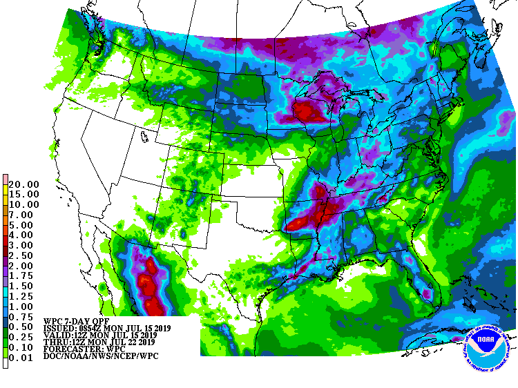
Today, Barry is expected to produce additional rain accumulations of 2 to 4 inches with isolated maximum amounts of 8 inches across Arkansas, western Tennessee and Kentucky, southeast Missouri, and northwest Mississippi. A heavy band of rain is currently impacting portions of central Louisiana into far southwest Mississippi. Additional rainfall of 3 to 5 inches with isolated totals of 8 inches is expected within this band through this afternoon, with storm total rainfall amounts up to 20 inches across Louisiana. Dangerous flash flooding is likely across this area into this afternoon.
As with any landfalling tropical cyclone, there’s a threat of small tornadoes in the general area of circulation around the storm. The National Hurricane Center says a couple of tornadoes are possible today from the Mid-South toward the Lower Ohio Valley. However, odds of tornadic formation will diminish as time continues.
The remnants of Barry will continue marching to the northeast for the balance of the week and into the weekend, bringing soaking rains with it. Portions of central New England, including the higher terrain of Vermont and New Hampshire, could see more than 3″ of rain from this system as it moves through.
