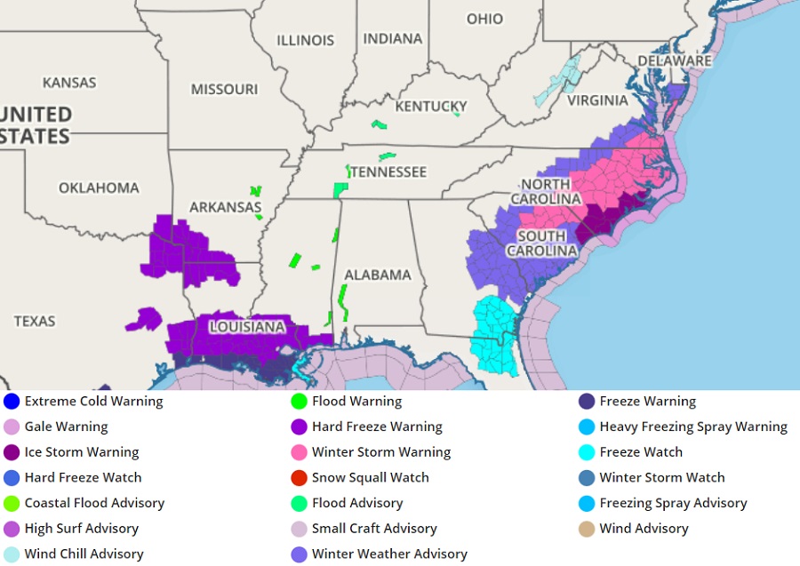
Heavy snow and accumulating ice is expected to coat portions of the Mid Atlantic and Southeast today into tomorrow, prompting the National Weather Service to expand where Winter Storm Warnings have been issued. Winter Storm Warnings are up for portions of central South Carolina, eastern North Carolina, and eastern Virginia while Winter Weather Advisories are up just north of this area, including south southeastern Maryland, southern South Carolina, and eastern Georgia.
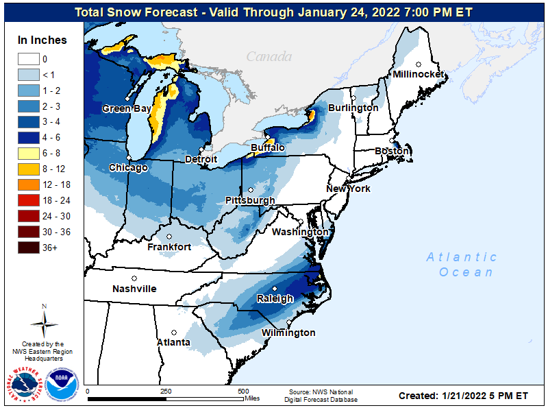
6″ or more of snow is expected over portions of North Carolina and Virginia again, yet another significant snowfall in an active winter weather season. Light snow will also accumulate over east-central Georgia, the northern 2/3rds of South Carolina, and much of North Carolina outside of the heavy snow belt. Because this storm system is going out to sea moreso than come up the coast, no snow is expected for Baltimore, Washington DC, Philadelphia, or Boston. Extreme southeastern New England, primarily the Cape Cod area, could be brushed with some light snow as this storm heads out deeper into the Atlantic.
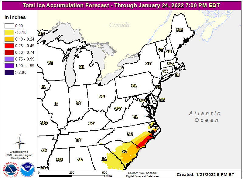
Beyond accumulating snow, accumulating ice is also possible. The thickest glaze of ice is expected over southeastern North Carolina and northeastern South Carolina. Ice will make travel, especially on untreated surfaces, unsafe if not impossible. A light glaze of ice is expected over much of South Carolina and eastern Georgia. In addition to roads and walkways, ice may also glaze trees and wires leading to power outages.
Fortunately, this east coast winter storm is a fast mover. The storm will head out to sea by early Saturday, allowing for high pressure to build back in. While conditions will be cold, they will be relatively dry. The next system will form along the Gulf coast on Monday/Tuesday and head east; until that storm arrives, conditions should be fair and dry in today’s winter storm zone for Sunday and Monday.
