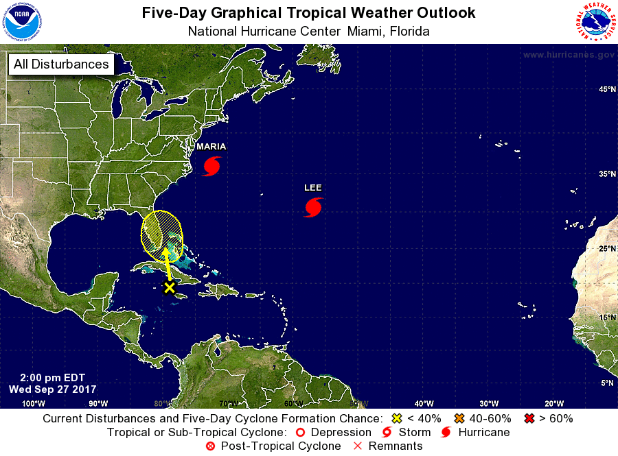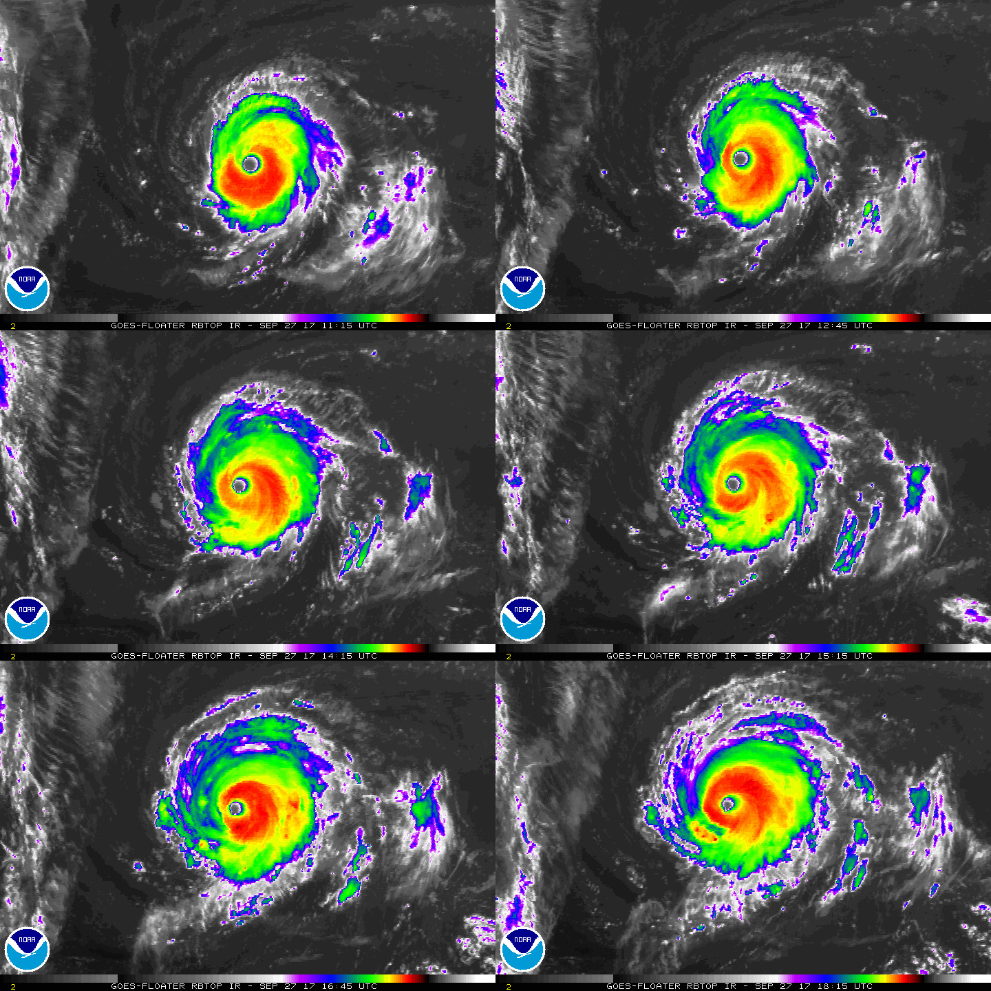
The Atlantic Hurricane basin remains active with Maria, Lee, and a new area of concern that could impact Florida over time. Tropical Storm Maria re-strengthened back to hurricane status this morning, joining Lee which is now a Major Hurricane in the Atlantic.
As of the 2:00pm update from the National Hurricane Center (NHC), Hurricane Maria was located near latitude 35.9 North, longitude 72.4 West, and moving toward the north-northeast near 6 mph. The NHC says this general motion is expected to continue throughout the day and then accelerate east-northeastward on Thursday and Thursday night. On the forecast track, Maria will move away from the coast of North Carolina through Thursday. Maximum sustained winds are near 75 mph with higher gusts. Hurricane-force winds extend outward up to 105 miles primarily to the northeast of the center, and tropical-storm-force winds extend outward up to 230 miles . An observing site at Jennette’s Pier in Nags Head, North Carolina, recently reported a sustained wind of 44 mph and a gust of 54 mph. The NHC expects Maria to weaken soon, becoming a Tropical Storm once again within the next 48 hours. The latest minimum central pressure reported by reconnaissance aircraft data is 979 mb (28.91 inches).
While the center of Maria won’t cross land, it’s impacts from its broad wind field will be felt across the Outer Banks. Today, a Storm Surge Warning is in effect for Ocracoke Inlet to Cape Hatteras while a Tropical Storm Warning is in effect for Ocracoke Inlet to the North Carolina/Virginia border and the Albemarle and Pamlico Sounds. A Storm Surge Watch is also in effect north of Cape Hatteras to Duck. A Storm Surge Warning means there is a danger of life-threatening inundation, from rising water moving inland from the coastline in
the indicated locations. The NHC cautions, “This is a life-threatening situation. Persons located within these areas should take all necessary actions to protect life and property from rising water and the potential for other dangerous conditions. Promptly follow evacuation and other instructions from local officials.” A Tropical Storm Warning means that tropical storm conditions are expected somewhere within the warning area.

Meanwhile, Hurricane Lee continues to spin about over the open waters of the Atlantic Ocean. Earlier today it was classified as a Major Hurricane with winds over 110mph; Lee is the fifth major hurricane of the 2017 Atlantic Hurricane Season. As of the last update from the NHC, Lee was located near latitude 30.6 North, longitude 56.8 West. Lee is moving toward the northwest near 7 mph and the NHC expects this motion to continue today. According to the NHC forecast, Lee should turn to the north on Thursday and accelerate to the northeast on Friday. Maximum sustained winds have increased to near 115 mph with higher gusts. Lee is a category 3 hurricane on the Saffir-Simpson Hurricane Wind Scale. Slow weakening is forecast during the next 48 hours. Hurricane-force winds extend outward up to 35 miles from the
center and tropical-storm-force winds extend outward up to 90 miles, making Lee a very small tropical cyclone. The estimated minimum central pressure is 963 mb (28.44 inches).
The National Hurricane Center is also tracking a new system that could impact Florida over time. An area of disturbed weather associated with a trough of low pressure is located over the northwestern Caribbean Sea. This system is forecast to move slowly north-northwestward across Cuba and the Straits for Florida during the next day or so. Some development of this system is possible when it moves near the Florida peninsula or the northwestern Bahamas on Friday or Saturday before upper-level winds become less favorable early next week. Regardless of development, this system is likely to produce locally heavy rainfall over portions of Cuba, southern Florida, the Florida Keys, and the Bahamas during the next several days. The NHC believes there’s a low chance of formation over the next 48 hours (10%) and a low chance of formation over the next 5 days (20%.)