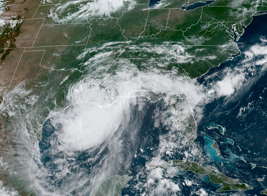
Hurricane Barry is making landfall onto the central Louisiana coast, slowly bringing its heavy rain to the central Gulf of Mexico coast. A variety of life-threatening impacts are happening now with more expected over the next 24 hours. While it is only a minimal category 1 hurricane, it has the potential to create a variety of problems over the next several days.
Life-threatening storm surge inundation is ongoing along the coast of southern and southeastern Louisiana, portions of Lake Pontchartrain, and portions of coastal Mississippi where a Storm Surge Warning is in effect.
Life-threatening, significant flash flooding and river flooding will become increasingly likely later today and tonight as Barry moves inland, especially across portions of south-central and southeast Louisiana into Mississippi. The slow movement of Barry will result in a long duration heavy rainfall and flood threat from Sunday into next week, extending from the central Gulf Coast north across the Lower to Mid Mississippi Valley and portions of the Tennessee Valley.
Hurricane conditions are occuring within portions of the Hurricane Warning area along the Louisiana coast. Tropical Storm conditions will continue along much of the Louisiana coast and will spread inland across portions of the lower Mississippi Valley where Tropical Storm Warnings are in effect.
Most people die in floods tied to landfalling hurricanes, not from wind. The National Weather Service reminds people: “turn around, don’t drown! Never drive through flood waters.”