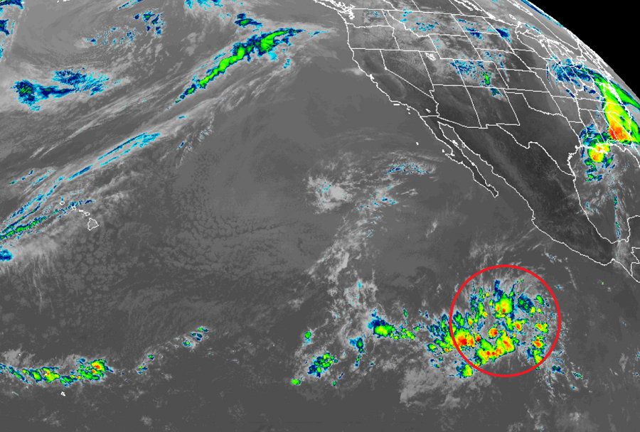
The National Hurricane Center is monitoring an extremely early-season disturbance in the eastern Pacific for signs of possible tropical development. While the Eastern Pacific Hurricane Season typically starts 2 weeks earlier than the Central Pacific and Atlantic Season on May 15, having a disturbance this early is extremely rare.
According to National Hurricane Center scientist Eric Blake, this disturbance is “highly anomalous and this would be over two weeks earlier than any tropical cyclone on record in that basin”; records for the basin are as old as the satellite era which began in 1966.
Due to the disturbance, the National Hurricane Center (NHC) in Miami issued a Special Tropical Weather Outlook to discuss the area of disturbed weather today. According to that Outlook, a large area of disturbed weather associated with a trough of low pressure formed several hundred miles south of the southern tip of the Baja California Peninsula. According to the NHC, environmental conditions are favorable for some gradual development for the next couple of days as the disturbance moves slowly northwestward. However, the NHC says that by late this weekend, conditions will become less conducive for development. The NHC believes there’s a 30% chance of tropical cyclone formation over the next 48 hours and a 40% chance over the next 5 days.
The Eastern Pacific Hurricane Season runs from May 15 to November 30 while the Central Pacific Hurricane Season, which includes Hawaii, and the Atlantic Hurricane Season, which includes the U.S. Gulf and East Coasts, begin on June 1; they too run through November 30.