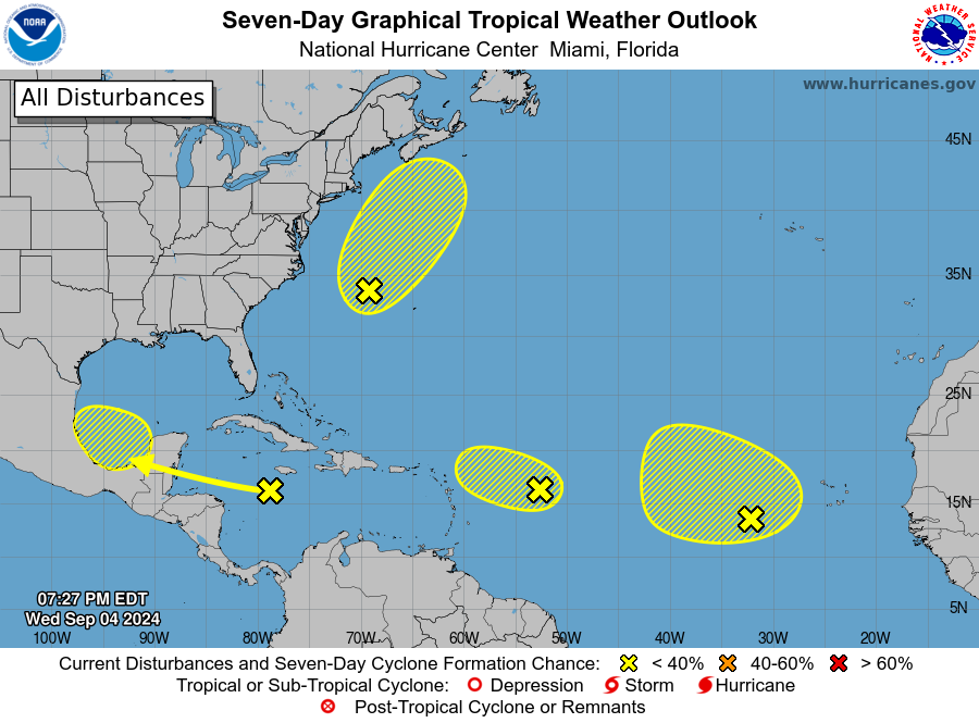
The National Hurricane Center announced in their latest Tropical Outlook that they are monitoring four areas across the Atlantic Hurricane Basin for signs of tropical cyclone development; however, all feature low-risk of growing into a tropical depression or tropical storm or worse in the coming days.

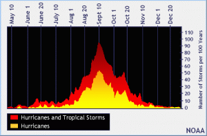
The official hurricane season for the Atlantic basin is from June 1 to November 30, but tropical cyclone activity sometimes occurs before and after these dates, respectively. The peak of the Atlantic hurricane season is September 10, with most activity occurring between mid-August and mid-October. But this year, the tropics are unexpectedly quiet. This week leading up to the 7 day period that ends on September 10, the traditional peak of the season, only four low-risk areas are being monitored for development.
The first of four is a non-tropical area of low pressure located a few hundred miles east of North Carolina. Today it produced disorganized showers and thunderstorms. The National Hurricane Center (NHC) says that this system could acquire some subtropical characteristics over the next few days while it moves north-northeastward, remaining offshore of the northeastern United States. However, there’s only a 10% chance of formation over the next 48 hours and only a 20% chance of formation over the next 7 days.
The second area being watched by the NHC is in the northwestern Caribbean Sea and southwestern Gulf of Mexico. There, a tropical wave moving quickly westward at about 20 mph; it is producing a broad area of disorganized showers and thunderstorms across portions of the west-central Caribbean Sea. The NHC says some development is possible in a few days when the system moves over the southwestern Gulf of Mexico. Odds are low though; the NHC says the chance of tropical cyclone formation is only 30% over the next 7 days.
The third area of concern is in the central Tropical Atlantic Ocean. Another tropical wave located several hundred miles east of the Lesser Antilles is producing disorganized shower and thunderstorm activity. The NHC says development of this system, if any, is expected to be slow to occur over the next couple of days while it moves west-northwestward at 10 to 15 mph. Environmental conditions are expected to become less favorable for additional development by the end of the week. As such, there’s only a 10% chance of formation at some point from the next 48 hours to the next 7 days.
The final area being watched is in the eastern Tropical Atlantic Ocean. A broad area of low pressure over the eastern tropical Atlantic is producing disorganized showers and thunderstorms. Some slow development of this system is possible during the next several days while it drifts northwestward. Chance of tropical cyclone formation over the next 48 hours is only 10% and over the next 7 days, it is only 20%.