The National Hurricane Center in Miami, Florida is busy tracking newly formed Tropical Storm Rose which joins Tropical Storm Peter which formed earlier today. In addition to Peter and Rose, the National Hurricane Center (NHC) is also tracking two additional systems that have a chance at becoming tropical or subtropical cyclones in the coming days.
Tropical Storm Peter isn’t forecast to have many impacts to land; it isn’t even forecast by the NHC to become a hurricane. Instead, it is forecast to weaken to a tropical depression while passing well east of the Bahamas by Wednesday. It could bring rain and wind to Bermuda, but it is unlikely it would be a hurricane or a tropical storm when it does so. Before it curves in the Atlantic, the southern portion of the storm could bring gusty rain showers to portions of Puerto Rico and the Virgin Islands later tomorrow into early Tuesday. While some rain could create some localized flooding issues, most precipitation and wind associated with the storm should remain well north and east of any land in the Caribbean.
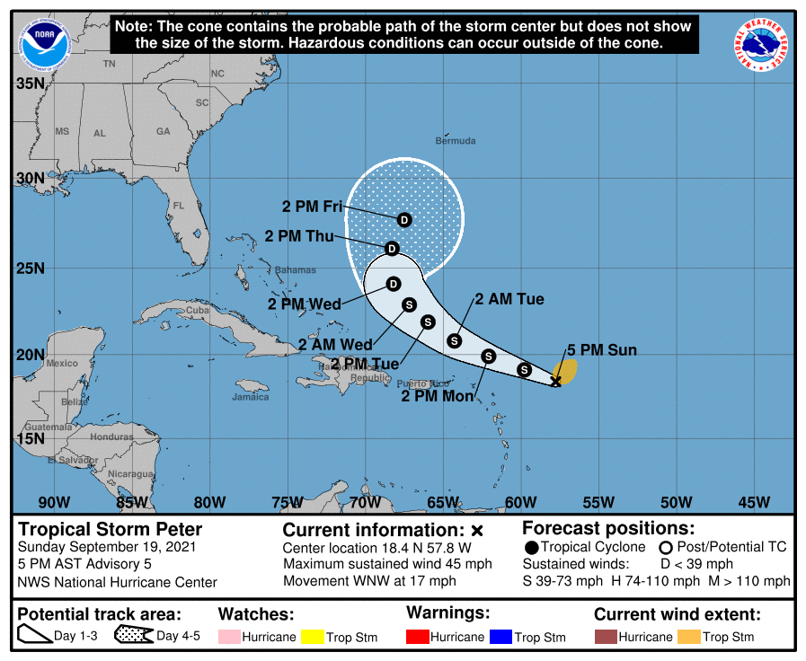
Tropical Storm Rose, the latest named storm for the busy 2021 Atlantic Hurricane Season, should not impact any landmass directly either. As the 17th named storm of the season, Rose is currently located about 370 miles west of the southernmost Cabo Verde Islands. With maximum sustained winds of 40 mph, it’s a weak tropical storm; moving north-north west at 16 mph, the storm has an estimated minimum central pressure of 1005 mb or 29.68″.
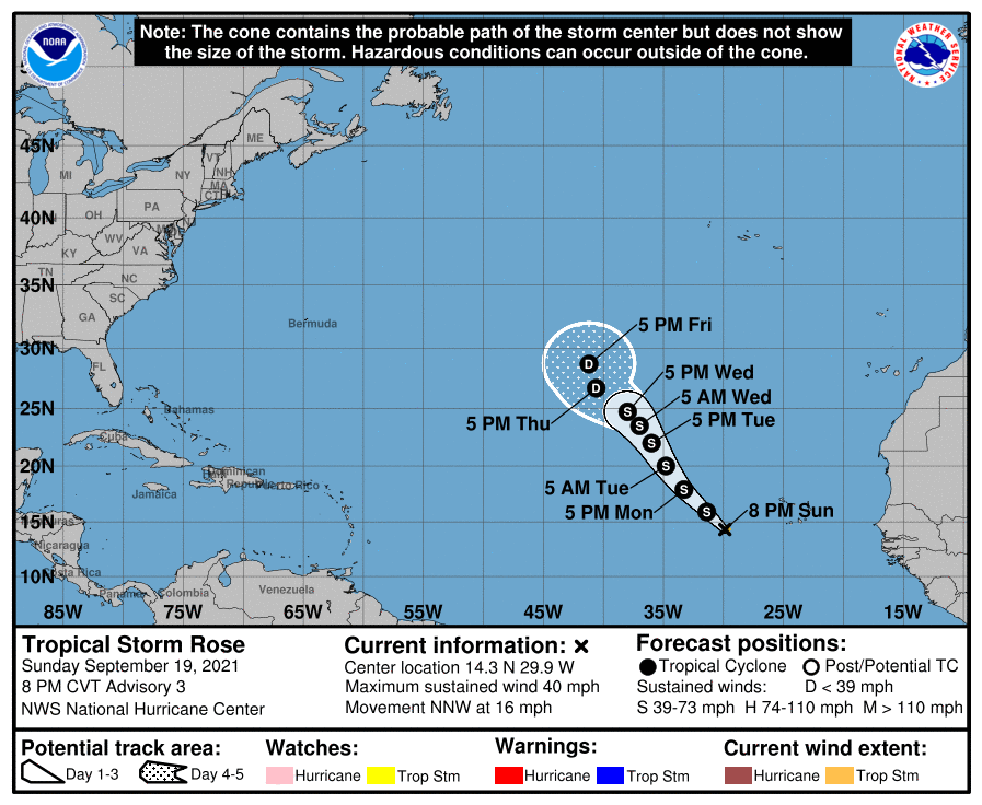
According to the NHC, Rose should pursue a motion toward the northwest later tonight and continue through Wednesday. While some strengthening is expected through Monday, by Tuesday, environmental conditions are expected to become less conducive, and Rose is forecast to begin a slow weakening trend over the open waters of the central Atlantic.
Even with some short term strengthening, Rose is expected to weaken back to tropical depression status by Thursday.
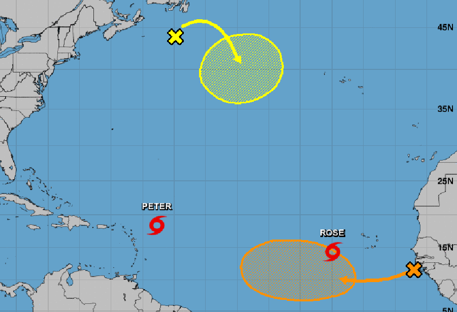
Elsewhere the Atlantic, the NHC is tracking two additional systems: one south of Newfoundland, and the other west of the west coast of Africa.
The first area of disturbed weather is a storm-force non-tropical low pressure system made up of the remnants of what was once Odette. This disturbance is currently located a couple of hundred miles south of Newfoundland. According to the NHC, this system could acquire some subtropical or tropical characteristics by the middle of this week as it moves slowly eastward and then southeastward over warmer waters across the north-central Atlantic Ocean. Staying over the open Atlantic, it is not expected to become a threat to land over the next five days. For now, the NHC says there’s a 30% chance of tropical cyclone formation here over the next five days.
The second area of concern is a patch of cloudiness and a few thunderstorms located over the eastern tropical Atlantic. This disturbance is associated with a tropical wave that is moving off the west coast of Africa. Environmental conditions appear conducive for gradual development over the next several days, and a tropical depression could form later this week as it moves westward at 10 to 15 mph across the eastern and central tropical Atlantic Ocean. The NHC says there’s a 50-50 shot that this disturbance could become a tropical cyclone over the next five days.
Elsewhere, there is no area of concern within the Atlantic Hurricane Basin. The Atlantic Hurricane Season runs through to the end of November.
