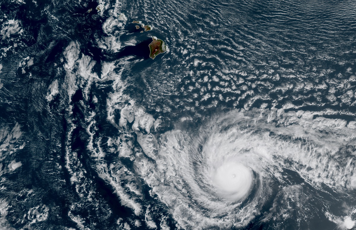
Hurricane Dora is passing well south of the Big Island of Hawaii today, but the broader weather pattern with a strong high pressure in place north of Hawaii and the significant hurricane south of it will bring the threat of damaging winds and fire weather to Hawaii, with the greatest risks on the Big Island of Hawaii beginning later tonight into Tuesday.
Hurricane Dora should remain far enough south of Hawaii to keep all clouds, precipitation, and wind associated with its circulation center away. However, as air rushes across the state from the high pressure north of Dora towards Dora’s center, winds will increase over the state. As winds move downslope on the leeward sides of the islands, especially on the Big Island where summits are almost at 14,000 feet, the air warms and dries, making it not only exceptionally windy, but exceptionally dry too, setting the stage for fire weather risks.
According to the National Weather Service, “fire weather” is the use of meteorological parameters such as relative humidity, wind speed and direction, mixing heights, and soil moisture to determine whether conditions are favorable for fire growth and smoke dispersion. Based on the analysis by meteorologists at the Honolulu office of the National Weather Service, Red Flag Warnings, indicating the presence of fire weather risks, have been issued for for large parts of each island, especially the western/leeward side areas which could be influenced the most by downslope flows.
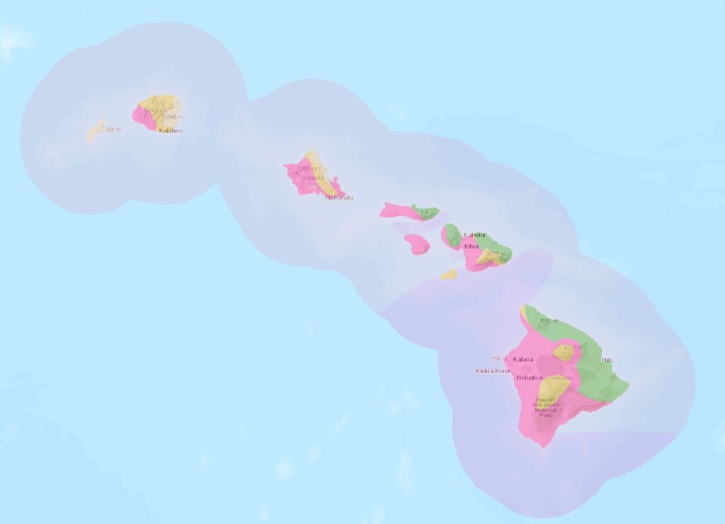
According to the National Weather Service, a Red Flag Warning means that critical fire weather conditions are either occurring now or will shortly. A combination of strong winds, low relative humidity, and warm temperatures can contribute to extreme fire behavior. However, the National Weather Service says that a Red Flag Warning does not predict new fire starts.
National Weather Service meteorologist John Bravender, who serves as the Warning Coordination Meteorologist for the Honolulu office, wrote in the latest forecast discussion that forecast soundings show a crashing inversion height, down below 3,000 feet and precipitable waters dropping to less than one inch, which is more than a standard deviation below normal for this time of year. The combination of strong winds and strengthening/lowering inversion to compress/accelerate the winds between inversion and terrain will lead to the potential for damaging trade winds tonight into Tuesday. The strongest winds are expected over mountain terrain and downslope into leeward areas, where a High Wind Warning is in effect. Elsewhere, exposed windward areas will also see strong winds and are covered by a Wind Advisory.
Wind speeds are expected to ramp up this afternoon over the Big Island of Hawaii and elsewhere across the state this evening, from east to west, with the window for strongest winds after midnight tonight through the day on Tuesday. East winds of 30 to 45 mph are expected, with gusts to or beyond 60 mph possible.
“Damaging winds may blow down trees and power lines and damage roofs,” the National Weather Service warns for those under the High Wind Warning. “Power outages are possible. Travel will be difficult, especially for high profile vehicles…The winds can forcefully open doors and damage hinges or slam doors shut, possibly causing injuries.”
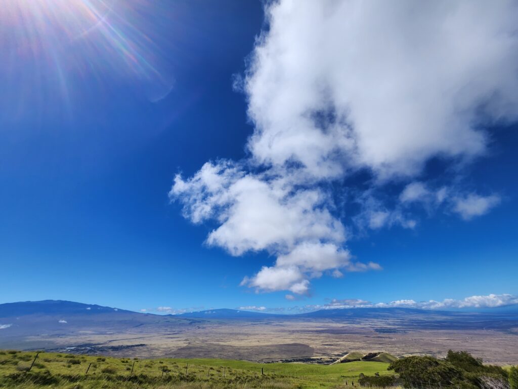
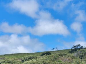
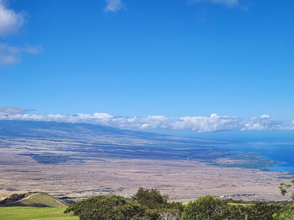
One place especially vulnerable to the damaging wind and fire weather risk is the South Kohala District of the Big Island of Hawaii, which includes the communities of Waikoloa, Waimea, and Kawaihae. Trade winds that normally blow across the Big Island are usually funneled through the “saddle” that exists between Mauna Kea and Mauna Loa volcanoes in the middle of the island; as this air funnels through the mountains, it picks up speed as it blows down into the South Kohala district into these communities.
But in a scenario such as the one unfolding now with a major hurricane to the south and a strong high pressure to the north, this are of typically strong winds will be further amplified, setting the stage for possible wind damage, as well as increasing fire hazards by drying out the landscape on those fierce winds.
While winds and fire hazards may be greatest in this part of the state, they will be present in other locations too, including Hawaii Volcanoes National Park which is located on the eastern side of the Big Island of Hawaii. Due to the threat posed by an elevated fire risk, the National Park Service closed some portions of the park on Sunday evening; those areas will remain closed until the elevated fire risk passes.
“Although rain is common at the summit of Kīlauea, other areas in the park are extremely dry with low humidity and the park has entered into a high fire risk index in those areas,” said Hawaii Volcanoes National Park Fire Operations Specialist Matt Desimone. “Safety is always our top priority, as well as the protection of the park’s cherished natural and cultural resources.”
Based on severe fire weather conditions in the forecast and elevated fire danger in some park areas, Mauna Loa Road will close to vehicles past the gate at Kīpukapuaulu and Hilina Pali Road will close to vehicles past the gate beyond Kulanaokuaiki Campground. However, pedestrians and bicycles are allowed.
In addition, all campfires and open flame cooking fires will be prohibited at Kīpukapuaulu day use area, Namakanipaio Campground, and the fire pit near the Kilauea Military Camp ballfield inside Hawaii Volcanoes National Park.
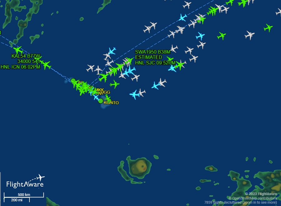
The strong winds created by this difference in pressure between the high pressure to the north and the major hurricane to the south will also lead to turbulent air travel in and around the islands. The National Weather Service writes, “The main aviation concern from this evening through Tuesday will be strong trade winds and moderate to severe low-level turbulence over and downwind of terrain….the inversion will lower tonight and winds will ramp up near the inversion level, raising the probability for severe low-level turbulence, most likely around and after midnight. These conditions will persist through Tuesday.”
Currently, flight tracking website FlightAware shows no significant delays or cancellations around Hawaii airspace nor does it show any flights leaving normal flight patterns due to the winds or the storm. This could change as conditions change tonight into Tuesday. People flying in or out of Hawaii on Tuesday should be prepared for the possibility of significant turbulence shortly after take-off or before landing due to the winds.
Another indirect impact from Hawaii from this weather pattern will be on its surf. Surf along east facing shores will quickly ramp up and become rough tonight through Wednesday due to a combination of very strong trades, large seas and a moderately sized, moderate period easterly swell generated from Major Hurricane Dora. The largest surf is expected over the eastern end of the state, where surf heights will reach warning levels from tonight through Tuesday afternoon. Surfers and swimmers, even expert ones, are urged not to enter into waters with a High Surf Warning until the hazard is over.
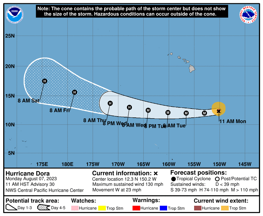
In the meantime, Major Hurricane Dora continues its steady progress to the west. As of the latest advisory from the Central Pacific Hurricane Center in Honolulu on the island of Oahu in Hawaii, Dora was located about 605 miles south-southeast of Hilo and about 1,325 miles east of Johnston Island. Maximum sustained winds are 130 mph, which makes Dora a major Category 4 hurricane on the Saffir-Simpson wind scale, which goes to 5. The storm was moving quickly to the west at 23 mph while its minimum central pressure was down to 953 mb or 28.15″.
While Dora won’t directly impact Hawaii, the Central Pacific Hurricane Center urges people on Johnston Island to closely monitor the storm in the coming days. However, there are only a few people with special permission of the U.S. Government ever on the island at any time. An unincorporated territory of the United States, administered by the United States Fish and Wildlife Service (USFWS), Johnston Island which is made up with the Johnston Atoll, is a National Wildlife Refuge and part of the Pacific Remote Islands Marine National Monument. It is closed to public entry, and limited access for management needs is only granted by letter of authorization from the United States Air Force and a special use permit from the U.S. Fish and Wildlife Service. For nearly 70 years, the isolated atoll was under the control of the U.S. military. During that time, it was variously used as a naval refueling depot, an airbase, a testing site for nuclear and biological weapons, a secret missile base, and a site for the storage and disposal of chemical weapons and Agent Orange. Those activities left the area environmentally contaminated and any disturbance by rough wind or seas by approaching tropical cyclones could be problematic.
For now, the Central Pacific Hurricane Center track brings Dora between Hawaii and Johnston Island, impacting neither as it moves to the west. While Dora has been a major hurricane for several days, some gradual weakening is forecast during the next 48 hours, followed by additional weakening through 72 hours.
Dora remains a relatively small hurricane. Hurricane-force winds extend outward up to 30 miles from the center and tropical-storm-force winds extend outward up to 115 miles.
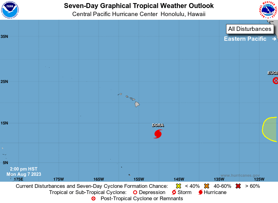
After Dora passes through the Central Pacific, eyes will return to the Eastern Pacific where a new system could develop over time. According to the National Hurricane Center, an area of low pressure could form several hundred miles south or southwest of the southwestern coast of Mexico by the end of the week. Some slow development of this system is possible this weekend while it moves generally westward. Even if something were to form, it would take more than a week and a half to reach Hawaii or the waters near it.