What appears to be a hurricane has formed east of New Jersey today, even though the calendar say’s it is January. The typical Atlantic Hurricane Season doesn’t begin until June and runs through November, making any January system a rare one. While rare, they aren’t impossible; there have been three on record, with the last one being Hurricane Alex in January 2016.
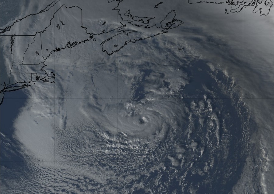
The system blossomed today over an unusually warm Gulf Stream which sends warm water up the off-shore waters of the East Coast from the Bahamas. Latest satellite imagery from the GOES-East satellite does show an eyewall of sorts forming, with satellite estimated wind speeds in the compact storm well over hurricane force.
To be considered an actual hurricane and earn a name, though, the National Hurricane Center (NHC) must make certain the system meets all criteria for hurricane status, including detailing the type of core the system has and the type of atmospheric structure that exists around and within the storm. As of their latest public outlook, the NHC wasn’t ready to label this as a tropical or subtropical storm.
“A non-tropical low pressure system centered over the northwestern Atlantic Ocean about 300 miles north of Bermuda is producing storm-force winds,” the NHC said today in a Special Tropical Outlook Update. “Although the cyclone is producing some thunderstorm activity near the center, it is embedded in a cold air mass with nearby frontal boundaries. The low is expected to move northeastward today and northward tonight, bringing the system over much colder waters and across Atlantic Canada by early Tuesday. Therefore, it is unlikely that the low will transition to a subtropical or tropical cyclone.”
If the system were to take on subtropical or tropical characteristics, it would be given the first name of the 2023 Atlantic Hurricane Season which will be “Arlene.”
Whether the system takes on more of those characteristics or not, it is still expected to remain a potent area of low pressure. The National Weather Service will issue advisories for it in their High Seas Forecasts. Because it is moving away from land, it is only a threat to shipping interests in the North Atlantic.
