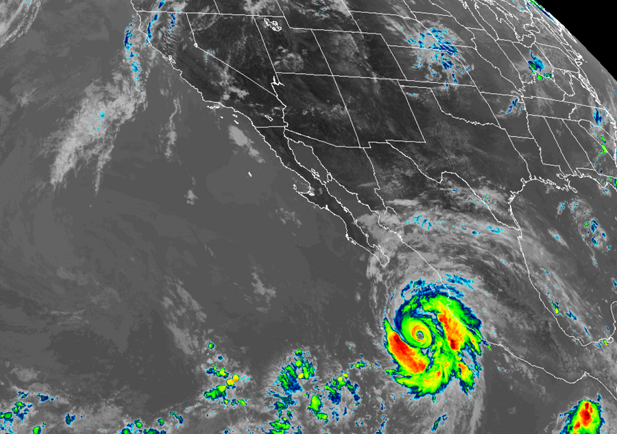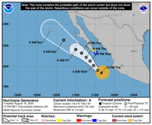
Hurricane Genevieve is a strong Category 4 hurricane on the Saffir-Simspon wind scale and experts with the National Hurricane Center (NHC) in Miami, Florida caution that additional strengthening is likely. While storm conditions will lash the west coast of Mexico, it appears unlikely that a direct landfall with the most severe parts of the storm will occur.
Because the storm will get close enough to Mexico to bring at least tropical storm conditions there, a Tropical Storm Warning is in effect for the southern Baja California peninsula from Los Barriles to Todos Santos while a Tropical Storm Watch is in effect for the east coast of the Baja California peninsula from Los Barriles to La Paz and along the west coast of the Baja California peninsula from Todos Santos to Santa Fe. A Tropical Storm Warning means that tropical storm conditions are expected somewhere within the warning area within 36 hours. A Tropical Storm Watch means that tropical storm conditions are possible within the watch area, generally within 48 hours.
In the latest advisory from the NHC, the clear eye of Hurricane Genevieve was located roughly 275 miles west southwest of Manzanillo, Mexico. Genevieve has maximum sustained winds of near near 130 mph with higher gusts and the NHC believes these will grow higher today, with additional rapid intensification possible. The estimated central minimum pressure is down to 950mb or 28.06 inches.

Genevieve is moving toward the northwest near 15 mph for now. According to the NHC, this general motion is expected to continue with a decrease in forward speed through early Thursday. On the forecast track, the center of Genevieve is expected to move parallel to but well offshore the coast of southwestern Mexico today. The center of the hurricane is then forecast to move to the southwest of the southern portion of the Baja California peninsula on Wednesday night and Thursday. While rapid intensification is expected today, weakening is forecast to begin by late Wednesday and should continue through the end of the week as the storm heads into cooler waters to the north.
While a direct landfall isn’t expected, tropical storm conditions are expected within the warning area in the southern Baja California peninsula by Wednesday afternoon, especially over higher terrain; tropical storm conditions are possible within the watch area by Wednesday night or Thursday morning, especially over higher terrain. Heavy rain and rough surf will be the primary hazards brought onto land within those tropical storm conditions. Rainfall amounts of 1-4″ are expected across portions of far southern Baja California Sur and portions of the southwest coast of Mexico. Large swells produced by Genevieve are affecting portions of the southern coast of Mexico and will spread northward along the southwestern and west-central coast of Mexico to the Baja California peninsula through Wednesday. These swells are likely to cause life-threatening surf and rip current conditions.