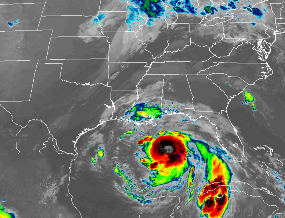
Hurricane Nate continues to chug north quickly towards the US Coast, targeting an area between New Orleans, LA and the western portion of the Florida panhandle. With Mississippi and Alabama at ground zero, landfall is expected late tonight.
Hurricane Nate is a fast mover, currently moving north at a quick 22mph to the north north west. Even after landfall tonight, Nate or its remnants should quickly accelerate north and east, bringing soaking rains to a large part of the eastern US before exiting the Atlantic coast early Tuesday.
Numerous hazards exist from Nate; efforts to protect life and property should rapidly come to completion.
Hurricane Nate Hazards
Wind
Along the northern Gulf Coast, hurricane conditions are expected in the hurricane warning area tonight, with tropical storm conditions expected to begin by this afternoon. Tropical storm conditions are expected in the tropical storm warning area tonight. Hurricane conditions are possible in the hurricane watch area tonight and tropical storm conditions are possible in the tropical storm watch area tonight and Sunday.
STORM SURGE
In the United States, the combination of a dangerous storm surge and the tide will cause normally dry areas near the coast to be flooded by rising waters moving inland from the shoreline. The water is expected to reach the following heights above ground if the peak surge occurs at the time of high tide:
- Morgan City, Louisiana to the mouth of the Mississippi River: 4 to 6 feet
- Mouth of the Mississippi River to the Alabama/Florida border: 5 to 9 feet
- Alabama/Florida border to the Okaloosa/Walton County Line: 4 to 6 feet
- Okaloosa/Walton County Line to Indian Pass, Florida: 2 to 4 feet
- Indian Pass to Crystal River, Florida: 1 to 3 feet
The deepest water will occur along the immediate coast near and to the east of the landfall location, where the surge will be accompanied by large and destructive waves. Surge-related flooding depends on the relative timing of the surge and the tidal cycle, and can vary greatly over short distances.
RAIN
Nate is expected to produce the following rain accumulations through Monday:.
- East of the Mississippi River from the central Gulf Coast into the Deep South, eastern Tennessee Valley, and southern Appalachians: 3-6″, up to 10″ in isolated areas
- Across the Ohio Valley into the central Appalachians: 2-4″, up to 6″ in isolated areas
TORNADOES
Isolated tornadoes will be possible beginning later today over parts of the central Gulf Coast region.
SURF
Swells generated by Nate will affect land areas around the western Gulf of Mexico during the next day or so. These swells are likely to cause life-threatening surf and rip current conditions.
