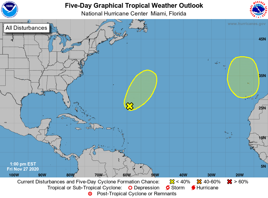
A record-breaking very busy hurricane season is wrapping up, with just 3 days left for both the Central Pacific and Atlantic Hurricane Basins. While there are no disturbances being tracked in the Central Pacific, the National Hurricane Center in Miami, Florida is monitoring two disturbances in the Atlantic for signs of possible development. Fortunately, odds of development are low and no system is forecast to impact the U.S. in the coming days.
According to the Nation Hurricane Center (NHC), an elongated, non-tropical low pressure system located over 500 miles southeast of Bermuda is producing limited shower activity due to dry air in the surrounding environment and strong upper-level winds. Conditions are expected to remain generally unfavorable for development this weekend as the low moves northeastward ahead of an approaching frontal system. By early next week, the system is expected to become absorbed by this frontal system over the north-central Atlantic. With such en environment so hostile for cyclone development, the NHC believes there’s only a 30% chance of development over the next 5 days; these are lower than the 40% odds they had on the system yesterday.
Another non-tropical area of low pressure is expected to form over the far eastern Atlantic and move southward well offshore of Portugal this weekend. This system could gradually develop subtropical characteristics early next week while it meanders offshore to the north of the Canary Islands. However, odds of this system are even lower than the first; the NHC says the chance of formation over the next five days is a low 20%.
While hurricane season ends in the basins around the U.S. on November 30, systems do sometimes form in the off-season. Should any systems develop and become named in the Atlantic, it would use unused letters from the Greek alphabet. Should a system form on or after January 1, it would take names from the fresh 2021 list.