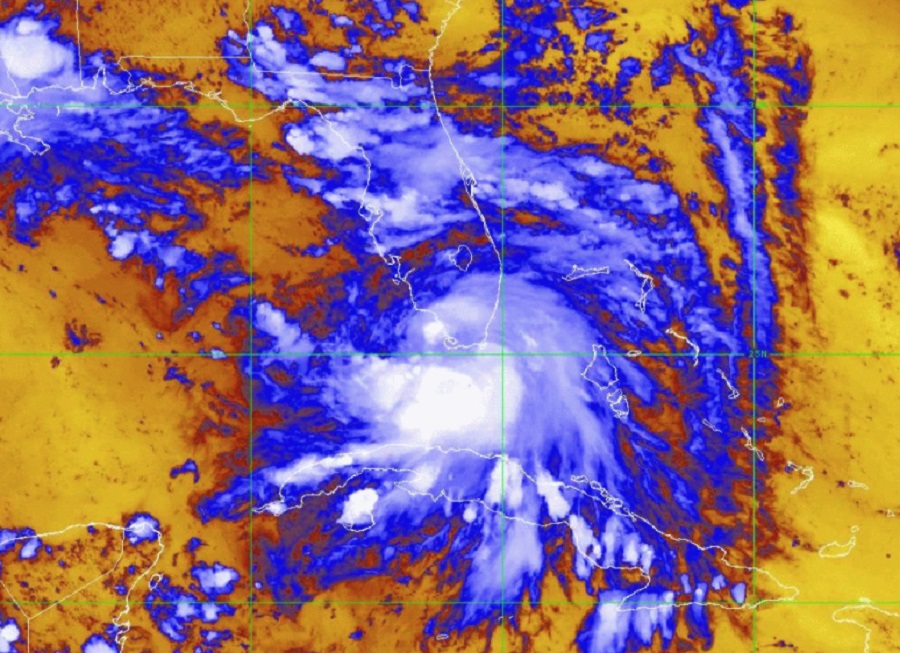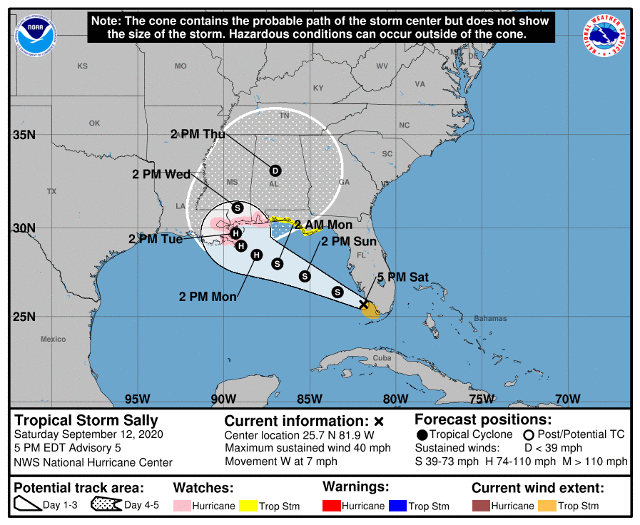
The National Hurricane Center in Miami, Florida has issued Hurricane and Storm Surge Watches ahead of Sally’s expected landfall along the central Gulf of Mexico coast.
A life threatening storm surge is possible along the Gulf Coast beginning on Monday. Because of this threat, a Storm Surge Watch is in effect for areas outside the southeast Louisiana Hurricane and Storm Damage Risk Reduction System from the Mouth of the Mississippi River to the Alabama/Florida border.
As of 5pm, the center of Tropical Storm Sally was located about 30 miles south-southwest of Naples, Florida. With minimum central pressure at 1004 mb or 29.65 inches, maximum sustained winds are at 40 mph.
According to the National Hurricane Center, Sally will move over the southeastern and eastern Gulf of Mexico tonight and Sunday and then move over the north-central Gulf of Mexico Sunday night and Monday. As the storm moves over warm Gulf waters, the National Hurricane Center expects it to intensify and become a hurricane by Monday.

With Sally expected to become a hurricane and strike the U.S. coast at hurricane strength, Hurricane Watches have been issued from Grand Isle, Louisiana to the Alabama/Florida border including Lake Pontchartrain and Lake Maurepas. The New Orleans metropolitan area is included in the Hurricane Watch. A Hurricane Watch means that hurricane conditions are possible within the watch area; it is usually issued 48 hours before the anticipated first occurrence of tropical-storm-force winds which are conditions that make outside preparations difficult or dangerous.
A Tropical Storm Watch is also in effect for the area stretching from the Alabama/Florida border to the Ochlockonee River in Florida. A Tropical Storm Watch means tropical storm conditions are possible within the watch area within the next 48 hours.