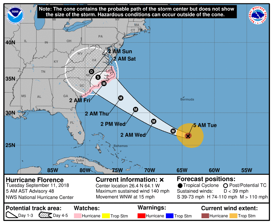
The National Hurricane Center has issued the first watches ahead of Major Hurricane Florence’s expected arrival on the U.S. East Coast. People in the watch areas should take the threat seriously, heed the advice of local officials, and take immediate steps to protect life and property. The National Hurricane Center warns that additional watches may be required elsewhere in the southeast and in the Mid Atlantic later today.
At 5am ET, a Storm Surge Watch was issued for the east coast of the United States from Edisto Beach, South Carolina northward to the North Carolina-Virginia border, including the Pamlico and Albemarle Sounds. A Hurricane Watch has also been issued for the same area. Additionally, a Storm Surge Watch is in effect for the Neuse and Pamlico Rivers. A Storm Surge Watch means there is a possibility of life-threatening inundation, from rising water moving inland from the coastline, in the indicated locations during the next 48 hours. A Hurricane Watch means that hurricane conditions are possible within the watch area. A watch is typically issued 48 hours before the anticipated first occurrence of tropical-storm-force winds, conditions that make outside preparations difficult or dangerous.
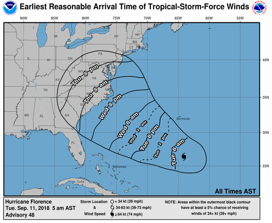
According to the latest update from the National Hurricane Center, the earliest tropical storm force winds would arrive on the U.S. East Coast would be just after 8pm Wednesday night.
More than 1.5million people have been asked to evacuate the coastline ahead of the hurricane’s arrival.
