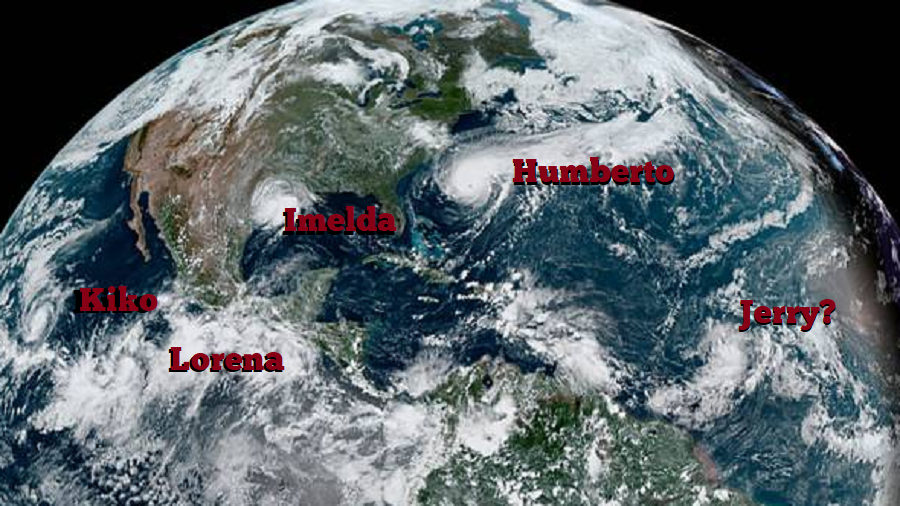
While Hurricane Humberto spins about between the southeastern United States and Bermuda, a new storm which formed a short time ago made landfall on the Texas coast: Imelda. And while residents of Texas deal with the season’s latest tropical storm, eyes are turning to another potential threat in the Atlantic. There, the National Hurricane Center (NHC) believes a hurricane will form; when named, this newest system will be called Jerry. Meanwhile in the Pacific, Kiko and Lorena continue to spin about there away from land.
Tropical Storm Imelda made landfall near Freeport, Texas a short time ago. The storm quickly evolved from a tropical depression to a tropical storm before coming ashore the Texas Gulf Coast. NOAA Doppler radar data and surface observations indicate that Tropical Storm Imelda made landfall at 1:00 PM CDT with maximum sustained winds of 40 mph. A National Ocean Service observing site at Freeport, Texas reported a minimum pressure near 1005 mb or 29.68 inches around the time of landfall. While the system doesn’t have much wind, it does have a tremendous amount of moisture to work with. Imelda could dump 5-10″ of rain with isolated amounts of 15″ across the upper coastal region of Texas into far southwest Louisiana through Thursday. This rainfall may produce life-threatening flash floods.

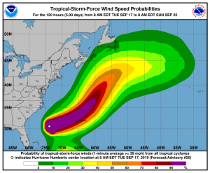
While Imelda will quickly lose strength, Hurricane Humberto continues to gain strength. Maximum sustained winds are near 100 mph with higher gusts and the NHC says some strengthening is forecast during the next 36 hours, and Humberto could become a major hurricane late tonight or Wednesday morning. Humberto is a large hurricane; hurricane force winds extend outward up to 60 miles from the center and tropical-storm-force winds extend outward up to 175 miles while the estimated minimum central pressure is 961 mb or 28.38 inches.
Because of the threat it poses, Bermuda has issued a Hurricane Watch for the island while a Tropical Storm Warning is in effect. A Hurricane Watch means that hurricane conditions are possible within the watch area, in this case within 36 hours. A Tropical Storm Warning means that tropical storm conditions are expected within the warning area, in this case within 24 to 36 hours.
While a direct impact on the U.S. coast isn’t expected from Humberto, indirect impacts are. Dangerous rough surf and rip currents are likely up and down much of the East Coast from Humberto and its swells. People are urged to exercise extreme caution if they’re going to enter the water to swim or to boat anywhere along the coast.

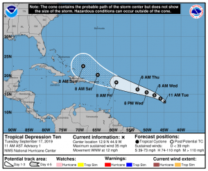
While Humberto is heading in the general direction of Bermuda, a new storm is growing in the Atlantic. Now known as Tropical Depression #10, the NHC expects this system will become a tropical storm and eventually a hurricane in the coming days. Once it’s named, it’ll be called Jerry. The latest forecast from the NHC brings the storm dangerously close to the Bahamas by Sunday morning. It is too soon to know what impacts, if any, Jerry would have on the U.S. East Coast.