A rapidly intensifying coastal storm off the U.S. southeast coast will create several days of headaches up the coast, prompting the National Weather Service to issue a slew of watches, warnings, and advisories ahead of its arrival. While the storm is getting its act together off the South Carolina coast today, it is forecast to be much better organized by tomorrow morning as it becomes vertically stacked with a closed 500 mb low moving overhead of the surface low. The National Weather Services expects gradual intensification of the low is forecast as it moves northeastward over the Atlantic with a minimum pressure dropping to somewhere around 990 mb or so by Monday morning.

The rain and wind in the southeast will shift into the Mid Atlantic tomorrow. There is also some indication that some form of a surface trough or the meteorological phenomena known as the Norlun Trough could begin to form tomorrow morning as the surface low moves closer towards the mid- Atlantic, allowing for an earlier onset of rain and rain showers across the New Jersey coast. Otherwise, a rain shield will push northward Sunday, affecting the DelMarVa and the immediate coast first, but eventually overspreading much of the I-95 corridor and points east from Baltimore to New York City by 1-3pm. Total rainfall amounts Sunday will be on the lighter side with most places only seeing up to 1/4 to 1/2″ along the immediate coast. Locations west of the Delaware River should see little if any rain.
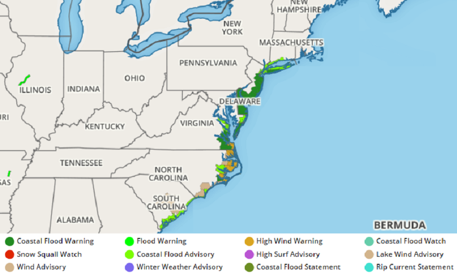
While the rain won’t be that impressive, the winds will be. Winds will remain similar, if not stronger than today with gusty northeast winds from 25 to 30 mph possible, and higher gusts from 45 to 50 mph in the Wind Advisory areas near and along the coast. With highs in the low to mid 40s, this will lead to another chilly day, especially once the rain begins, as the wind chill factor makes conditions feel colder than they actually are. Winds could cause power outages; they’ll be strong enough to topple some branches and wires. People with outdoor decorations should make sure they’re secure before the strongest winds hit.
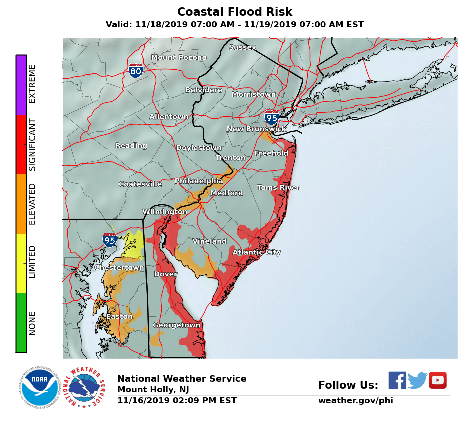
Winds will pound surf along the coast, leading to moderate coastal flooding and beach erosion. The greatest threat of coastal flooding will be at the Jersey Shore from Sandy Hook to Cape May; there’s also a threat of coastal flooding along the entire Delaware coast and the northern part of Delaware Bay in southwestern New Jersey. Coastal flooding could also be an issue up the Delaware River into Philadelphia and Trenton along with the Raritan Bay in central New Jersey.
The National Weather Service is also concerned with the potential of freezing rain on the back-side of the storm. While not a widespread concern, forecast soundings suggest light freezing rain is possible across Sussex County, NJ and into the
southern Poconos. Timing of this icing potential will be highly dependent on how fast a vorticity maximum moving in from the west amplifies the longer wave synoptic trough associated with the coastal storm.
