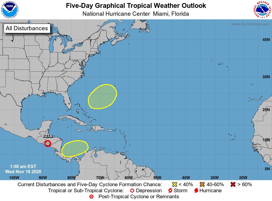
While rescue and recovery efforts continue in Central America where the remnants of what was once Major Hurricane Iota fades away, two new areas are being monitored for potential cyclone development in the Atlantic by the National Hurricane Center (NHC).
According to the NHC, the first, a disturbance just east of Central America could form in the coming days. It appears a broad area of low pressure could form in a day or so over the southwestern Caribbean Sea. Fortunately for an area hit hard by Eta and Iota, environmental conditions are expected to be only marginally conducive for slow development over the next several days while the system moves slowly west-southwestward or westward across the southwestern Caribbean Sea. Unfortunately, regardless of tropical cyclone formation, areas of heavy rain are possible during the next several days from Nicaragua southward across Central America and into Colombia. These rains could cause new flooding concerns, especially across previously inundated areas. The NHC believes there’s a 30% chance that a tropical cyclone will form here in the next 5 days.
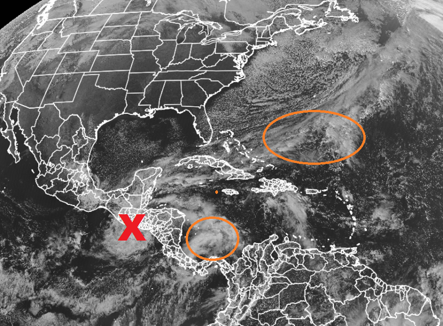
The second area of concern is south and east of the U.S. coast between the Bahamas and Bermuda. The NHC says a non-tropical area of low pressure could form here by early next week. They add that the system could gradually develop subtropical characteristics through the middle of next week while it moves northeastward. For now, the chances of development are low: over the next five days, the NHC believes there’s only a 20% chance of cyclone formation here.
Elsewhere, the NHC doesn’t expect tropical cyclone development in the Atlantic Hurricane Basin for the next five days. The Atlantic Hurricane Season runs through the end of this month; however, some active seasons do have storms develop in December
