
Isaias continues to push north, assaulting states with flash flood generating heavy rains, coastal storm surge, damaging winds, numerous tornadoes, and destructive wind gusts. The tropical cyclone made landfall as a strong Category 1 hurricane with 85 mph winds in southern North Carolina around 11:10 PM near Ocean Isle Beach. The storm lost some steam as it moved into central, eastern North Carolina; the National Hurricane Center downgraded it back to a strong tropical storm at 3am. But with winds of 70 mph, Isaias remains a high-end tropical storm just shy of hurricane status.
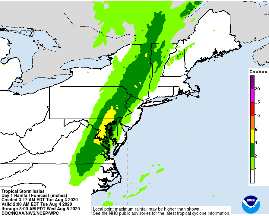
Heavy rain has advanced well north of the center of circulation, with heavy rain and strong thunderstorms marching into New England. An additional 4-6″+ of rain is expected over the next 12 hours, with the heaviest rain falling over eastern portions of Virginia, Maryland, and Pennsylvania.
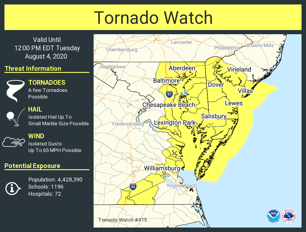
In addition to heavy rain, Isaias is lashing the east coast with severe winds and numerous tornadoes. With so many tornadoes forming and more possible, the National Weather Service has issued a Tornado Watch through to noon for portions of New Jersey, Maryland, Virginia, and all of Delaware.
Isaias is a quick mover and conditions will dry out quickly in the southern and central Mid Atlantic by lunch time today. By dinner, the tropical storm will be on its way to Canada in northern New England, leaving fair skies and much calmer winds in its wake.
The National Hurricane Center is tracking another system in the central Atlantic for possible tropical cyclone development. However, that system is not expected to impact any land for at least the next 5 days.
