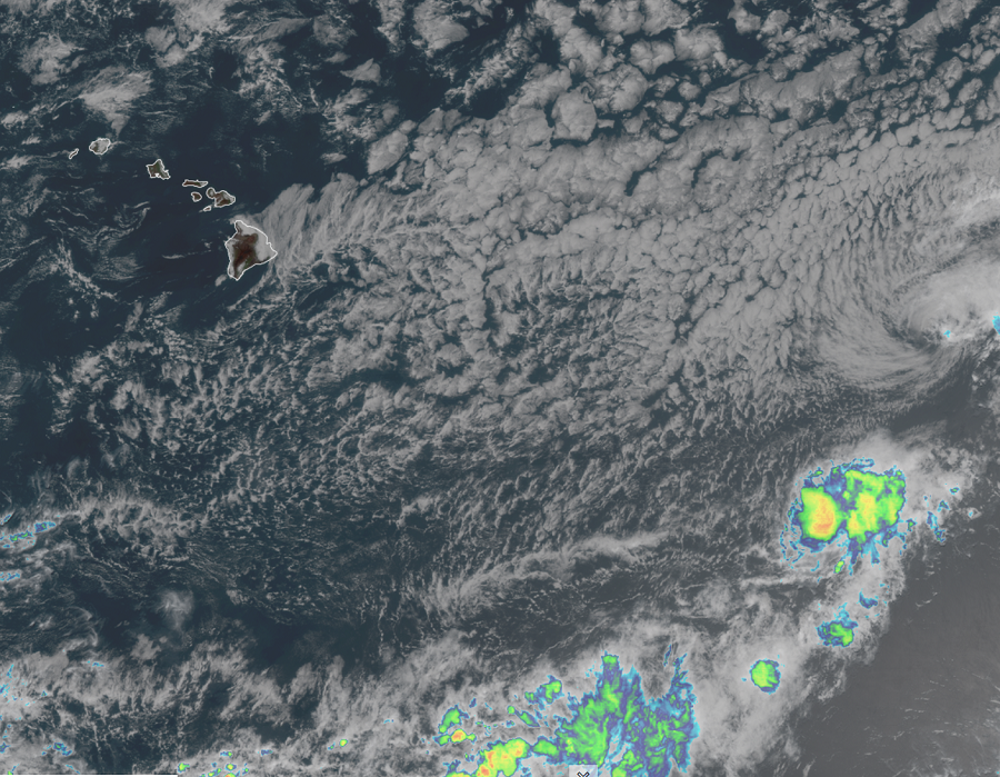
Tropical Depression Jimena has crossed the 140 West line of longitude, shifting it from the Eastern Pacific to the Central Pacific hurricane basin, and as such, the National Hurricane Center in Miami, Florida has handed off future advisories for this system to the Central Pacific Hurricane Center in Honolulu, Hawaii. However, there isn’t much to hand-off: Jimena has weakened to a tropical depression and is forecast to degenerate further into a remnant low by late tonight or tomorrow. Remnant moisture will bring some much needed rains to wildfire-stricken portions of Hawaii while it could also pose a flooding threat to other areas.
As of the latest official advisory, the center of Tropical Depression Jimena was located near latitude 17.6 North, longitude 140.0 West, which is roughly 1,000 miles east of Hilo on the Big Island of Hawaii. The depression is moving toward the west-northwest near 8 mph and this general motion is expected to continue through Saturday morning. A turn toward the west is forecast to occur by late Saturday. Maximum sustained winds have decreased to near 35 mph, although there could be some higher gusts. Continued weakening is forecast by the Hurricane Center during the next couple of days, and Jimena is expected to degenerate into a remnant low later today or tonight. For now, the estimated minimum central pressure is 1008 mb or 29.77″.
Computer forecast guidance suggests that while the structure of Jimena will fade, its moisture will continue to march west to Hawaii during the early part of next week. This moisture could produce much needed rainfall over areas hit hard by wildfire near Waimea and Waikoloa on the west side of the Big Island. However, east side towns, including Hilo, could have flooding concerns if too much rain falls too quickly in a short period of time. While people on Hawaii and elsewhere in the state don’t need to worry about a tropical cyclone impact in the immediate future, attention should be paid to the increasing amounts of moisture coming to the Aloha state over the next few days.