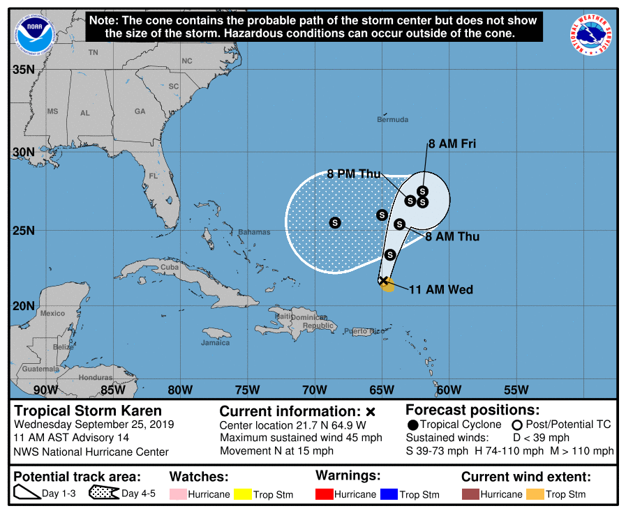
Tropical Storm Karen is moving away from Karen, but is forecast by the National Hurricane Center (NHC) to loop well east of the Bahamas and head west towards the Bahamas and perhaps the U.S. East Coast over time.
As of the latest update from the NHC, the center of Tropical Storm Karen was located near latitude 21.7 North, longitude 64.9 West. Karen is moving toward the north near 15 mph (24 km/h). A north-northeastward to northeastward motion with a decrease in forward speed is expected through early Friday. Karen is then expected by the NHC to slow down and make a clockwise loop over the southwestern Atlantic into the weekend. Maximum sustained winds are near 45 mph with higher gusts. Some strengthening is forecast during the next couple of days. For now, tropical-storm-force winds extend outward up to 70 miles from the center. The estimated minimum central pressure is 1003 mb or 29.62 inches.
Karen is expected to produce additional rainfall accumulations of 1 to 2 inches across Puerto Rico and the Virgin Islands, with isolated storm totals of 8 inches. These rains may cause flash flooding and mudslides, especially in mountainous areas. Some areas in southeastern Puerto Rico have already received up to 5 inches of rainfall, which has caused some flooding.
It is still too early to say with certainty how strong Karen will get or what path it’ll take as it moves west towards the Bahamas and the U.S. East Coast over time.