Tropical Storm Kirk is forecast by the National Hurricane Center (NHC) to lose steam as it marches west into the Caribbean; meanwhile, it is likely that a tropical depression will form south of Hawaii today and the Central Pacific Hurricane Center (CPHC) could eventually name that system Walaka.
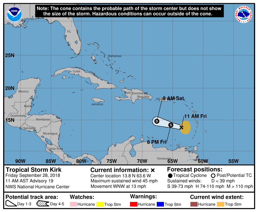
In the latest update from the National Hurricane Center, the center of Tropical Storm Kirk was located near latitude 13.8 North, longitude 63.6 West. Kirk is moving toward the west-northwest near 13 mph, and this motion is expected to continue through Sunday. On the forecast track, the center of Kirk or its remnants will move across the eastern and central Caribbean Sea over the next day or two. Reports from an Air Force Reserve Hurricane Hunter aircraft indicate that maximum sustained winds have decreased to near 45 mph with higher gusts. According to the NHC, Kirk is forecast to weaken to a tropical depression tonight, and then degenerate into a trough of low pressure on Saturday. Tropical-storm-force winds extend outward up to 105 miles mainly to the east of the center. The latest minimum central pressure estimated from the Hurricane Hunter aircraft data is 1007 mb or 29.74″.
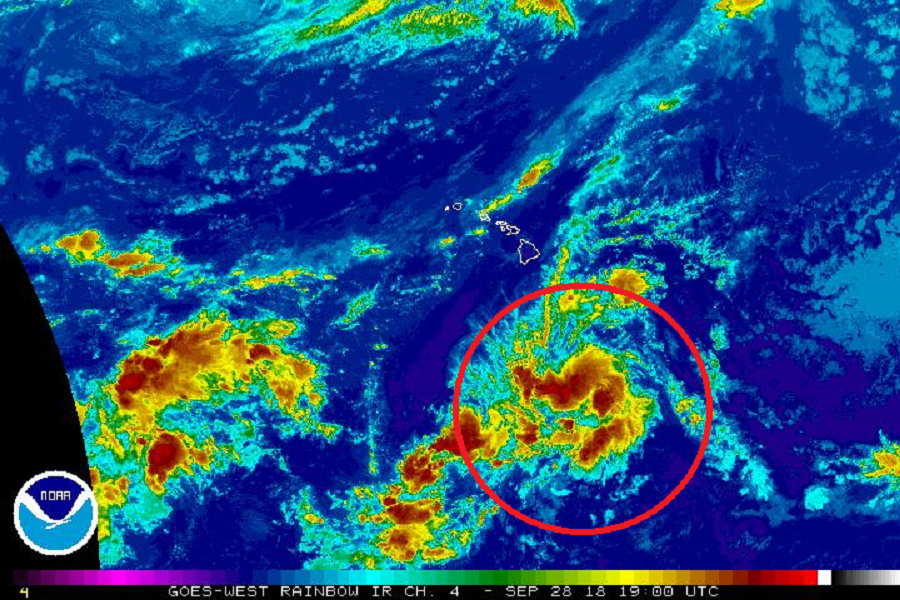
Meanwhile, the Central Pacific Hurricane Center is likely to classify a system near Hawaii sometime today. According to the CPHC, showers and thunderstorms associated with a low level circulation center located about 600 miles south-southeast of Hilo, Hawaii continues to become better organized. A tropical depression is likely to form as soon as later today while the system moves west at about 15 mph, away from the islands of Hawaii. Global computer forecast guidance forecasts that this system will likely become a tropical storm or even a hurricane over time; that same guidance suggests the storm should remain away from Hawaii for now. According to the CPHC, there’s a 80% chance of tropical cyclone formation here in the next 48 hours.
