
Laura will be making its last impacts in the United States tomorrow, bringing an end to a destructive history that claimed many lives. Laura hit the Louisiana coast as a strong Major Category 4 hurricane on early Thursday morning. The system is now a weak tropical depression that will continue to fade with time.
With Laura fading, the National Hurricane Center in Miami, Florida issued its last advisory on the storm today at 5pm ET. At that time, Laura was located about 10 miles northwest of Paducah Kentucky and had maximum sustained winds of only 30 mph. The system is moving to the east northeast at 21 mph.
For the balance of today, Flash Flood Watches remain up for portions of Kentucky, Tennessee, and central Alabama. Tornado Watches are also in effect for parts of Kentucky, Middle Tennessee, as well as northern Mississippi and Alabama. With the system well away from the coast, there are no coastal watches or warnings in effect.
The remains of Laura will cross the central Appalachians early Saturday, before becoming absorbed by an approaching cold front that is forecast to move off the mid-Atlantic coastline by late Saturday. While earlier forecasts suggested the system could re-intensify back to tropical storm strength as it exited the Mid Atlantic region, that is no longer expected for now.
Nevertheless, some rough conditions are expected between now and tomorrow night as Laura departs the coast. Heavy rain, gusty winds, and even tornadic cells are possible.
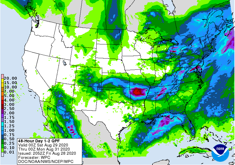
An additional rainfall of 1-3″, with maximum amounts up to 5″ are forecast across western and central Kentucky and Tennessee, and south into northern Alabama and Mississippi. 1-2″, with isolated totals to 4″ will be possible over southern Louisiana, Mississippi, and Alabama. 1-3″ are possible over the central and southern Appalachians and the mid-Atlantic states through Saturday. This rainfall will continue to cause isolated flash and urban flooding, and small streams and creeks to overflow their banks across the aforementioned regions. Minor to moderate river flooding is occurring or forecast to occur in Louisiana, Arkansas, and northern Mississippi.
Gusty winds will accompany the tropical depression as it moves along the Lower Ohio Valley through tonight. Some thunderstorms may be able to tap into additional strong winds well above the surface, creating damaging wind gusts; the greatest threat of this happening will be from New Jersey south to North Carolina along the Mid Atlantic coast.
A few tornadoes remain possible, mainly over parts of Mississippi, Alabama, and Tennessee tonight. The risk for a couple of tornadoes should redevelop Saturday afternoon and evening over parts of the mid-Atlantic from Virginia to North Carolina. An isolated tornado cannot be ruled out as far north as central Upstate New York or Vermont or as far south as central South Carolina.
Some storms may also create large hail. The greatest threat of large hail is over central and southern Vermont, southwestern New Hampshire, western Connecticut and Massachusetts, eastern Upstate New York, and extreme northeastern Pennsylvania.
