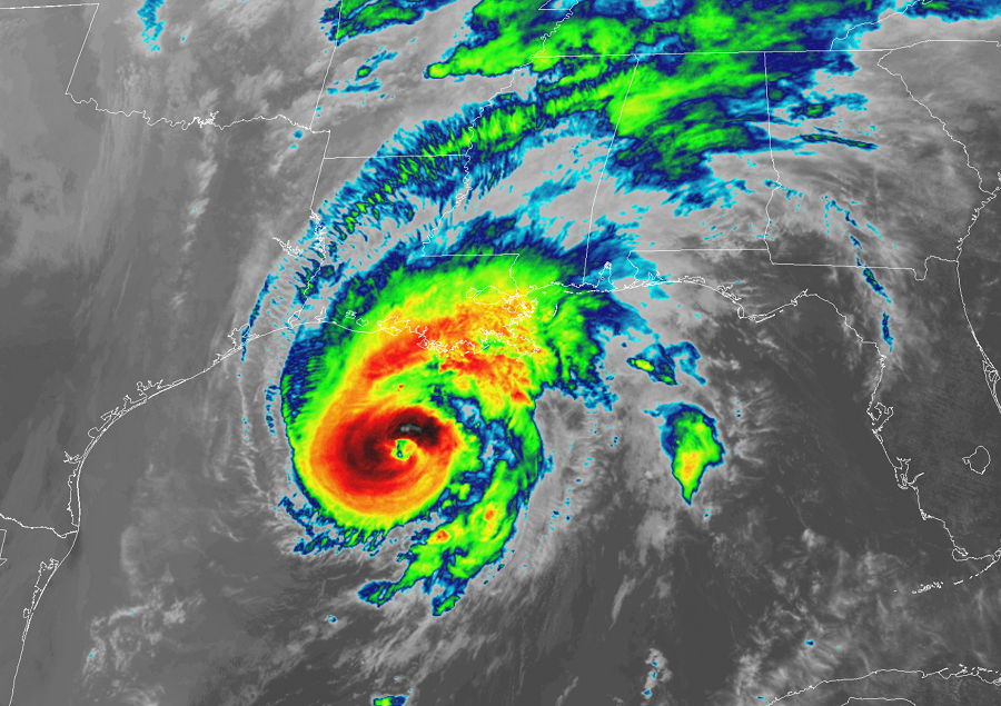
Hurricane Zeta intensified to a strong Category 2 hurricane today and has its eyes set on striking the Gulf Coast, a region hit hard by many storms earlier this season. Louisiana has been hit by 4 named storms this season: Cristobal, Marco, Laura, and Delta. And it appears that Zeta will be the fifth, breaking the record for most landfalls in Louisiana in a single hurricane season. When Hurricane Zeta strikes Louisiana later today, it will be 11th continental U.S. Atlantic landfalling named storm this year, well exceeding the previous record of 9 set in 1916. Zeta is expected to lash portions of the Gulf Coast with flooding rains, life-threatening storm surge, wind damage, and the threat of isolated tornadoes. Flooding rains and wind damage are expected far inland as the storm heads up into the Mid Atlantic by Friday. As cold air wraps around the backside of the intense coastal storm, some accumulating snow is also possible in portions of the northeast before Zeta completely clears the coast.
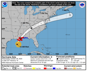
As of the last advisory from the National Hurricane Center, Hurricane Zeta was located only 235 miles south-southwest of New Orleans, Louisiana with maximum sustained winds of 90 mph. Additional strengthening is possible prior to Zeta’s expected landfall later today. The storm is moving due north at 18 mph. Minimum central pressure is down to 976 mb or 28.82 inches.
With Zeta approaching the coast, numerous warnings are in effect. A Storm Surge Warning is in effect from the Mouth of the Atchafalaya River to Navarre, Florida; this includes Lake Borgne, Lake Pontchartrain, Pensacola Bay, and Mobile Bay. A Storm Surge Warning means there is a danger of life-threatening inundation, from rising water moving inland from the coastline. “This is a life-threatening situation,” warns the National Hurricane Center. ” Persons located within these areas should take all necessary actions to protect life and property from rising water and the potential for other dangerous conditions. Promptly follow evacuation and other instructions from local officials.” A Hurricane Warning is in effect from Morgan City, Louisiana to the Mississippi/Alabama border, including Lake Pontchartrain, Lake Maurepas, and Metropolitan New Orleans. A Tropical Storm Warning is in effect from the Mississippi/Alabama border to the Walton/Bay County Line in Florida. A Hurricane Warning means that hurricane conditions are expected somewhere within the warning area. Preparations to protect life and property should be rushed to completion.
While Zeta is gaining strength, it is also moving quick and will move even faster over time. According to the National Hurricane Center, a faster northward to north-northeastward motion is expected through tonight followed by an even faster northeastward motion on Thursday and an east-northeastward motion early Friday. On the forecast track, the center of Zeta will make landfall in southeastern Louisiana this afternoon. Zeta will then move close to the Mississippi coast this evening, and move across the southeastern and eastern United States on Thursday. While Zeta will strike Louisiana as at least a Category 2 hurricane, it will weaken as it moves further inland. However, tropical storm strength winds are likely as far north as western North Carolina and could be felt as far north as southern New Jersey.
In the south, Zeta will pose multiple threats including storm surge inundation, wind damage, isolated tornadoes, and flooding rains. In the north, beyond flooding rains and gusty winds, snow is also possible as colder air wraps around the back side of this system.
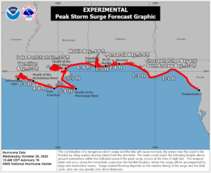
Along the northern Gulf Coast, the combination of a dangerous storm surge and the tide will cause normally dry areas near the coast to be flooded by rising waters moving inland from the shoreline. The water could reach 6-9 feet high from the Mouth of the Pearl River to Dauphin Island, Alabama; 5-8′ is possible along the eastern Louisiana coast while 2-4′ is possible from the Alabama/Florida border to Navarre, Florida, including Pensacola Bay. The deepest water will occur along the immediate coast near and to the right of the landfall location, where the surge will be accompanied by large and dangerous waves. Surge-related flooding depends on the relative timing of the surge and the tidal cycle, and can vary greatly over short distances.
Hurricane wind conditions are expected within the Hurricane Warning area on the northern Gulf Coast this afternoon, with tropical storm conditions beginning later this morning. Damaging winds, especially in gusts, will spread well inland across portions of southeastern Mississippi, Alabama, and northern Georgia this evening through early Thursday morning, and into the Carolinas and southeastern Virginia on Thursday. Wind gusts could be especially severe across the southern Appalachian Mountains on Thursday.
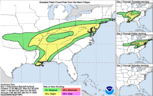
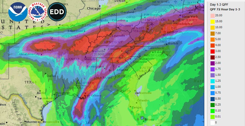
Areas of heavy rainfall, both in advance of and along the track of Zeta, will impact areas from the central Gulf Coast to the Mid-Mississippi and Ohio Valleys, and eastward into the southern to central Appalachians and Mid-Atlantic today through Thursday. Rainfall totals of 2-4″ with isolated amounts of 6″ are expected across these areas, resulting in flash, urban, small stream, and minor river flooding.
A few tornadoes are expected this afternoon through tonight over southeastern parts of Louisiana and Mississippi, southern Alabama, and the western Panhandle of Florida. This tornado threat will move inland as the spiraling bands from Zeta spin their way deeper into the southeastern states.

As cold air wraps around the backside of the storm late Thursday into early Friday, a period of snow is possible over portions of the northeast. Northern New Jersey, northeastern Pennsylvania, upstate New York, northern Connecticut and Rhode Island, western and central Massachusetts, Vermont and New Hampshire, and portions of southern Maine could see snow fall at times as the storm moves through. The snow could even accumulate, especially over higher terrain of New York, Massachusetts, Vermont, and New Hampshire. Snowfall accumulations will generally be 1-3″, however an isolated pocket of 3-6″ can’t be ruled out over the highest terrain.
All precipitation will end from west to east by Friday morning as high pressure returns to the eastern United States. While the tropics will be calm for now, the 2020 Atlantic Hurricane Season Continues. While the latest Tropical Outlook from the National Hurricane Center shows any tropical cyclones developing over the next 5 days, meteorologists at the Miami, Florida-based facility to believe more tropical cyclones will form this season. The season doesn’t officially end until the end of November.