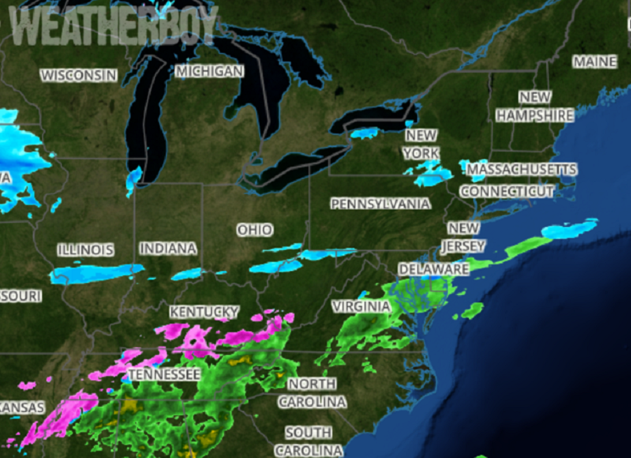
Much of the light snow associated with storm 2 of a parade of 3 that has impacted portions of the Mid Atlantic and Northeast in recent days is starting to fade away as much of the moisture associated with it slides off shore. However, the disturbance responsible for this snow will produce additional snow over a small area of the Mid Atlantic later today into tomorrow, namely over portions of eastern West Virginia, much of western and central Maryland, and northern and central Virginia.
As this system completely wraps up and moves out tomorrow, eyes will focus on the third weather system to impact the region in 7 days: a possible ice storm for Sunday. Current guidance suggests sleet and/or freezing rain may be the dominant precipitation type along the I-95 corridor from Washington, DC to New York City on Sunday.
Before then, though, the National Weather Service is reporting on how much snow fell from this latest system:
DELAWARE
Kent County
Smyrna 5.5″
Dover 3.5″
Woodside 3.3″
New Castle County
Glasgow 4.0″
Bear 4.0″
Middletown 3.8″
Odessa 3.8″
Glasgow 3.5″
Fairfax 3.3″
Hockessin 3.2″
Talleyville 3.1″
New Castle County Airport 2.8″
Sussex County
Milford 0.5″
MARYLAND
Allegany County
Frostburg 4.8″
Anne Arundel County
Glen Burnie 2.8″
BWI Airport 2.6″
Odenton 1.7″
Annapolis 1.5″
Baltimore County
Long Green 5″
Timonium 4.7″
Glyndon 4.5″
White Marsh 3.6″
Baltimore City
Pikesville 5.0″
Pimlico 4.9″
Hamilton 4.7″
Calvert County
Dunkirk 0.3″
Carroll County
Sykesville 5.2″
Eldersburg 5.1″
Mount Airy 4.7″
Cecil County
Glen Westover 3.5″
Elkton 3.5″
Woodlawn 3.1″
Frederick County
Frederick 5.5″
Mount Pleasant 4.8″
New Market 4.7″
Garrett County
Frostburg 7.8″
Mountain Lake Park 7.3″
Warnocks 7.0″
Kent County
Old Town 4.5″
Rock Hall 3.5″
Montgomery County
Damascus 4.1″
Clarksburg 4.0″
Rockville 1.8″
Gaithersburg 1.6″
Potomac 0.7″
Queen Annes County
Barclay 4.0″
Kent Island 1.5″
NEW JERSEY
Atlantic County
Somers Point 4.8″
Smithville 4.6″
Absecon 4.0″
Galloway Township 4.0″
Brigantine 3.8″
Estell Manor 3.8″
Atlantic City International Airport 3.4″
Folsom 3.0″
Hammonton 3.0″
Somers Point 2.5″
Burlington County
Medford 3.1″
Hainesport 2.8″
Burlington 2.5″
Mount Laurel 2.4″
Lumberton 2.3″
Marlton 2.3″
Columbus 2.0″
Camden County
Winslow Township 4″
Lindenwold 3.3″
Blackwood 3.0″
Sicklerville 3.0″
Haddon Heights 2.5″
West Berlin 2.5″
Gloucester City 2.3″
Cherry Hill 2.0″
Cape May County
Ocean City 3.0″
Gloucester County
Pitman 4.7″
Sewell 4.2″
Mantua 3.7″
Washington Township 3.6″
Williamstown 3.6″
West Deptford Township 3.4″
Hudson County
Harrison 1.7″
Hunterdon County
Ringoes 3.7″
Raritan 2.8″
Tewksbury Township 1.8″
Mercer County
Ewing 3.4″
Hamilton Square 2.5″
Hopewell 2.3″
Middlesex County
Cheesequake 2.8″
North Brunswick 2.8″
Cranbury 2.6″
Woodbridge 2.5″
Edison 1.9″
Parlin 1.9″
Monmouth County
Ramtown 2.8″
Howell 2.5″
Manalapan Township 2.5″
Colts Neck 2.0″
Cream Ridge 2.0″
Morris County
Brookside 1.5″
Denville 1.3″
Lake Hopatcong 1.3″
Ocean County
Forked River 5.5″
Beach Haven 4.5″
Harvey Cedars 4.1″
Manahawkin 3.8″
Tuckerton 3.8″
Toms River 3.5″
Bayville 3.4″
Brick 3.2″
Jackson 2.6″
Lakewood 2.0″
Passaic County
Bloomingdale 0.9″
Salem County
Malaga 3.5″
Pennsville 3.3″
Alloway 3.0″
Somerset County
Hillsborough Twp 2.5″
Bridgewater 2.3″
Raritan 1.5″
Sussex County
Andover 1.4″
Warren County
Hope 2.1″
Stewartsville 2.1″
Oxford 2.0″
Marksboro 1.5″
Hackettstown 1.5″
Blairstown 1.3″
Union County
Cranford 2.0″
Pennsylvania
Berks County
Bechtelsville 2.5″
Union Twp 1.9″
Bucks County
Lower Makefield Township 3.0″
Newtown 2.7″
Chalfont 2.5″
Newtown 2.5″
Yardley 2.5″
Carbon County
Albrightsville 1.0″
Chester County
Lincoln University 4.0″
Exton 2.3″
Jennersville 2.3″
East Coventry Township 1.6″
Delaware County
Chadds Ford Township 3.1″
Upper Chichester Township 2.9″
Upper Darby 2.9″
Morton 2.7″
Lehigh County
Coopersburg 2.6″
New Tripoli 2.2″
Lehigh Valley International Airport 2.1″
Monroe County
Rossland 1.8″
Arlington Heights 1.4″
Mount Pocono 1.2″
Montgomery County
Norristown 3.4″
Plymouth Meeting 2.6″
King of Prussia 2.3″
Lansdale 2.3″
Willow Grove 2.3″
Ambler 2.0″
Horsham Township 1.9″
Pottstown 1.8″
Northampton County
Bushkill Township 1.7″
Philadelphia County
Point Breeze 3.5″
Philadelphia International Airport 3.1″
Fox Chase 2.6″
CONNECTICUT
Fairfield County
Norwalk 2.8″
Greenwich 2.2″
Easton 1.5″
NEW YORK
Bronx County
Laguardia Airport 1.2″
Nassau County
East Meadow 1.6″
Plainview 1.6″
East Williston 1.6″
Syosset 1.4″
New York County
Central Park 1.3″
Queens County
JFK Airport 2.2″
Richmond County
Westerleigh 2.5″
Tompkinsville 2.1″
Suffolk County
Saint James 2.0″
Riverhead 1.8″
Sayville 1.7″
VIRGINIA
Arlington County
Arlington 0.3″
Barcroft 0.2″
Fairfax 0.2″
Clarke County
Mount Weather 1.0″
Berryville 1.0″
Fairfax County
Vienna 1.0″
Reston 0.5″
Herndon 0.3″
Falls Church 0.3″
Fauquier County
Warrenton 1.0″
Frederick County
Cross Junction 2.4″
Stephens City 0.6″
Loudoun County
Leesburg 1.0″
Ashburn 1.0″
Hughesville 1.0″
Purcellville 0.8″
Round Hill 0.6″
Dulles International Airport 0.5″
Prince William County
Manassas 5 SE 0.2″
Dale City 0.1″
Shenandoah County
Strasburg 4 N 0.3″
WEST VIRGINIA
Berkeley County
Winebrenners Cross 4.2″
Martinsburg 4.0″
Falling Waters 3.8″
Grant County
Bayard 9.0″
Kline Gap 4.0″
Petersburg 4.0″
Hardy County
Rig 4.0″
Jefferson County
Charles Town 2.4″
Bloomery 1.7″
Mineral County
Keyser 7.1″
Burlington 6.1″
