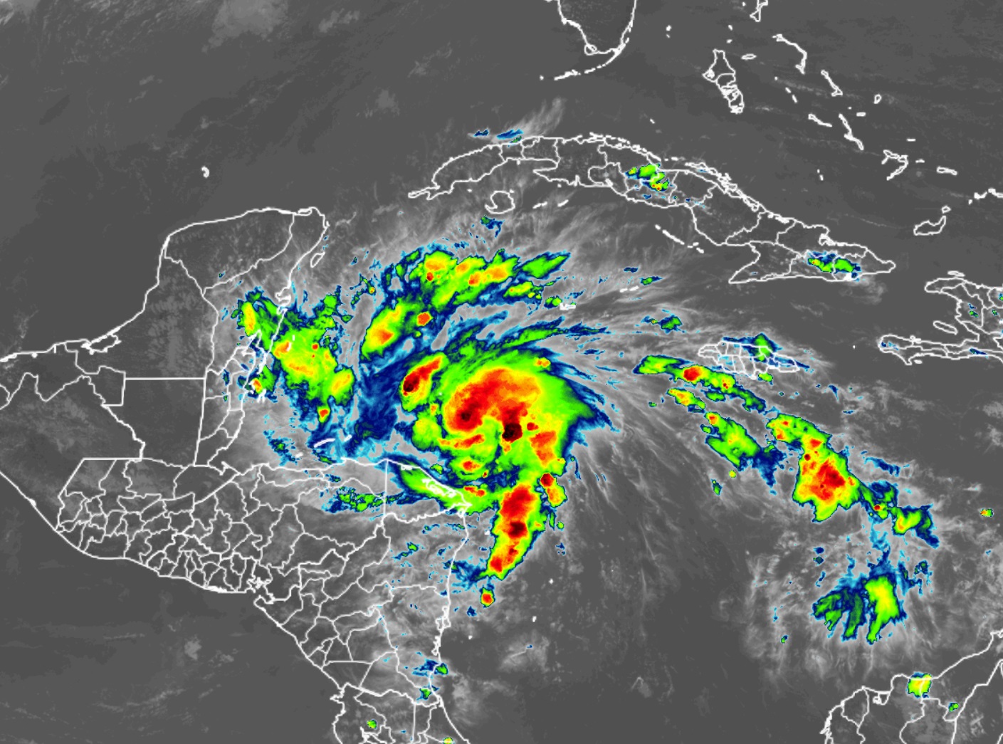
According to the National Hurricane Center, Tropical Storm Lisa is forecast to rapidly intensify into a hurricane tonight before threatening portions of Central America in the coming days. People in the storm’s path are being urged to take steps now to protect life and property ahead of the dangerous storm.
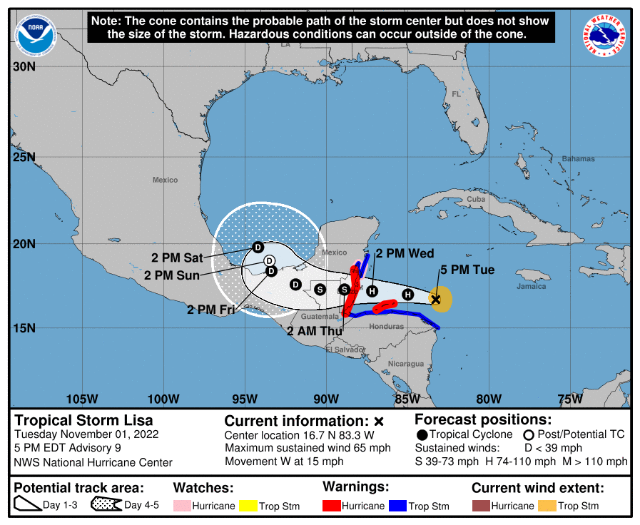
Right now, Lisa is a tropical storm located about 220 miles east of Isla Roatan, Honduras and about 330 miles east of Belize City, Belize. The storm has maximum sustained winds of 65 mph and a minimum central pressure of 1000 mb or 29.53″. The storm is moving to the west at 15 mph.
With the storm moving into Central America, Hurricane Warnings have been issued for the area north of Puerto Barrios to south of Chetumal while a Hurricane Watch has been issued for Chetumal to Puerto Costa Maya, Mexico. A Tropical Storm Warning is also in effect for the entire north coast of Honduras, the north coast of Guatemala, and for the area between Chetumal to Punta Herrero, Mexico. A Hurricane Warning means that hurricane conditions are expected somewhere within the warning area. Preparations to protect life and property should be rushed to completion. A Hurricane Watch means that hurricane conditions are possible within the watch area. A Tropical Storm Warning means that tropical storm conditions are expected somewhere within the warning area within 36 hours.
While Lisa is moving west for now at 15 mph, the National Hurricane Center (NHC) expects the motion to continue but at a slower speed in the coming days. The NHC also says significant intensification is likely, with Lisa becoming a hurricane overnight tonight over the northwestern Caribbean and continue to gain intensity tomorrow. On the forecast track, the center of Lisa will move near or over the Bay Islands of Honduras early Wednesday, move near Belize late on Wednesday and over southeastern Mexico on Thursday.
The official track from the National Hurricane Center also brings Lisa over open water in the southern Gulf of Mexico this weekend. It is too soon to know where the system will go beyond that and/or if it’ll re-intensify after its journey over land in Mexico.
One thing is certain though: heavy rain and wind is likely in the storm’s path. Rainfall amounts of 4-6″ with isolated amounts up t0 10″ are possible across Belize, the Bay Islands of Honduras, northern Guatemala and the southeast portion of the Mexican state of Chiapas. Rain amounts of 2-4″ with local amounts to 6″ are possible across the far southeastern portion of the Yucatan Peninsula, Northern Honduras, and central Guatemala. This rainfall could lead to flash flooding conditions primarily across Belize into northern Guatemala, the southeast portion of the Mexican state of Chiapas and the far southeast portion of the Yucatan peninsula.
Due to the storm intensifying into a hurricane, there is also a growing threat of storm surge. A storm surge will likely raise water levels by as much as 4-7 feet above normal tide levels along the immediate coast of Belize in areas of onshore winds, with 2-4 feet possible within the Hurricane Watch area in eastern Yucatan and 1-3 feet for the Bay Islands of Honduras. Near the coast, the surge will be accompanied by large and damaging waves.
