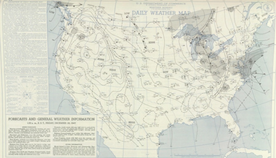
The National Weather Service Cooperative Weather Observing Station at Long Branch, New Jersey has set a new state-wide 24-hour snowfall record of 29.7″. What makes this record even more interesting is when it happened: December 26-27, 1947. A comprehensive review of weather records was conducted by the State Climate Extremes Committee (SCEC) to determine that this 1947 record accurately reflects a record snowfall amount, different from a 32″ amount that was previously considered to be the state record from a 1915 storm.
The SCEC convenes to adjudicate potential weather and climate records for validity. If a measurement or observation is validated, the SCEC considers it for the state record for that type of record type. The SCEC is composed of members representing the Mount Holly, New Jersey and Upton, New York offices of the National Weather Service, the National Weather Service’s Eastern Region Headquarters System Operations Division (SOD) in Bohemia, New York, the Northeast Regional Climate Center in Ithaca, New York, the National Centers for Environmental Information in Asheville, North Carolina, and the Office of the New Jersey State Climatologist at Rutgers University in New Brunswick, New Jersey.
Prior to this review, the 24-hour snowfall record for New Jersey was a 32″ amount recorded in Charlotteburg on December 14, 1915. Located about 30 miles northwest of New York City and roughly 12 miles south of the New Jersey/New York border in northwestern New Jersey, it was long believed that this measurement was accurate. However, further analysis determined that the heavy snow likely fell over a period greater than a 24 hour window.

The SCEC also evaluated another weather observation of heavy snow made on January 23, 2016 in Bernards Township. The observer for that location reported a 30″ snowfall. After reviewing that observer’s records, station site, and other nearby station observations, the SCEC voted unanimously 5-0 to reflect that observation as a new 24-hour record for New Jersey.
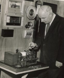
After reviewing other data from significant snowstorms over the years, the SCEC determined that an observation site in Long Branch provided the most accurate, most likely location and observation for a record snowfall. Long Branch, located on the northern Jersey Shore in Monmouth County, is located 32 miles due south of Midtown Manhattan. In 1896, a Storm Warning display station was established in Long Branch near the ocean at a telephone company building under the jurisdiction of the U.S. Weather Bureau, which would eventually become the National Weather Service. From that time through the 1970s, various observers have taken regular, accurate weather readings at that site.
According to weather logs reviewed by the SCEC, a snowstorm that hit New Jersey was clearly documented on the site in December 1947. On Christmas Day, the observer indicated a depth of 0.6″. On December 26, snow started at 4am with 28.4″ of snow having a 3.43″ liquid equivalent was recorded. On December 27, snow fell through to 4am, with an additional 1.3″ of snow and 0.13″ liquid equivalent. Based on that record, 29.7″ was observed at the site over the 24 hour period.
The SCEC examined other nearby observations throughout the New Jersey / New York area for that major December 1947 snowstorm. All-time single-storm records were set at the climate stations at Newark Airport and Central Park of 26.0 inches and 26.4 inches, respectively. These records held until January 7-8, 1996 at Newark and February 11-12, 2006 at Central Park. The heaviest totals were over two feet across Bergen, Hudson, Passaic, Essex, and much of Union
counties, as well as pockets of eastern Monmouth County. Event totals surpassed 30″ inches at cooperative stations in West Milford in Passaic County, with 28.0 to 29.0 inches falling in nearby Ringwood and Wanaque as well as 26.0 inches in Little Falls and 24.0 inches in Paterson. In Bergen County, 27.0 inches fell in Lyndhurst, Old Tappan, and Ridgewood at unofficial locations and by a cooperative observer in Ridgefield. Jersey City in Hudson County reported 26.2 inches at their cooperative observing site. Cooperative observers in Union County measured 26.0 inches in Elizabeth, Rahway, and Westfield. According to the National Weather Service, amounts tapered off west and south, with the exception of parts of northern and eastern Morris County and the Monmouth County coast, which received below 20 inches. Snowfall amounts in Monmouth County unofficially reached as high as 30.0 inches at Keyport and Red Bank, while 20.0 inches was measured at Fort Hancock on Sandy Hook and only 16.0 inches in Freehold. Amounts were as low as 5.0 inches at the Millville Municipal Airport in South Jersey.

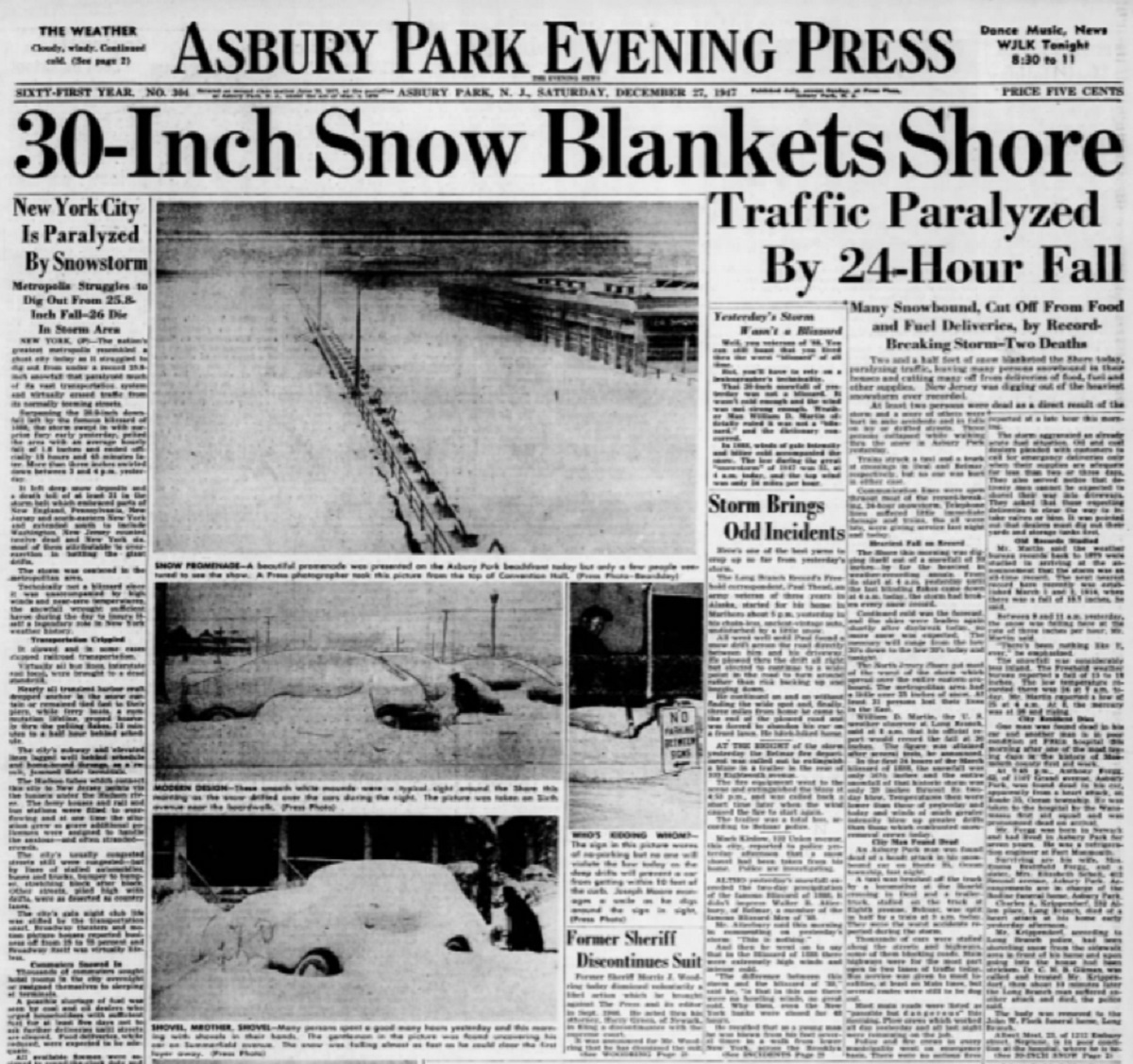
According to the U.S. Weather Bureau, 23 people were killed by the storm in New Jersey. Most of the deaths were people trapped in their vehicles, with many being workers who were trying to get home from work in the snow. An article that appeared in the Bergen Evening Record newspaper reported that 200 people spent the night of December 26 stranded at the Hackensack Municipal Bus Terminal, unable to get home. The winter storm disaster was covered by local media, including the Asbury Park Evening Press which documented the heavy snow.
Based on their thorough review, the SCEC determined that the observation in Long Branch was accurate and was a true reflection of the most accurate measurement of a maximum 24 hour snowfall reported in the Garden State to date.