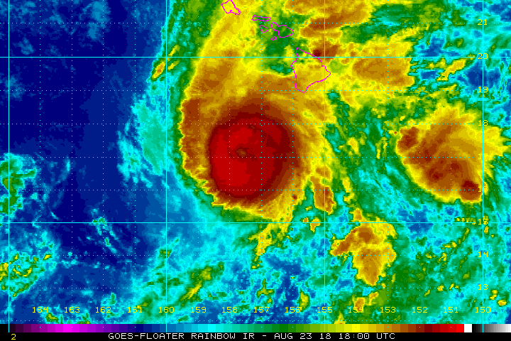
Hurricane Lane is slowly moving northwest, inching closer and closer to the islands that make up the State of Hawaii. As of the 8:00am HT / 2:00pm ET advisory from the Central Pacific Hurricane Center (CPHC), the center of Hurricane Lane was located by satellite and radar imagery near near latitude 17.1 North, longitude 157.6 West. Lane is creeping along to the northwest near 7 mph. According to the CPHC, a turn toward the north-northwest and little change in forward speed is expected today. The official CPHC forecast projects a turn toward the north tonight and Friday as Lane’s forward motion slows. Beyond tomorrow, a turn toward the west is expected on Saturday and Sunday, with an increase in forward speed.
On the forecast track, the center of Lane will move very close to or over the portions of the main Hawaiian islands later today through Friday. It is important to remember that this is a large storm and that impacts will be felt far from where the center is. At this time, hurricane force winds extend outward up to 35 miles from the center while tropical storm force winds extend out up to 140 miles from the center. NOAA buoy 51002 located about 250 miles southwest of
the Big Island recently reported sustained winds of 71 mph and a gust of 94 mph. Beyond the wind field, heavy rain will extend hundreds of miles from the center.
Maximum sustained winds are near 130 mph with higher gusts. Lane is a powerful category 4 hurricane on the Saffir-Simpson Hurricane Wind Scale. Steady weakening is forecast during the next couple of days. However, Lane is expected to remain a hurricane as it draws closer to the islands.
The estimated minimum central pressure is 949 mb or 28.03 inches.
Extremely heavy rain will fall from this hurricane. The CPHC expects heavy rain in the 10-20″ range, with some areas picking up 30″ or more of rain. The rain has already created significant floods on Hawaii’s Big Island. Heavy rains have also triggered numerous landslides, blocking roads and trapping communities. Highway 19 near Honomu on Hawaii’s north coast and Route 270 in northwest Hawaii are two such roads closed due to landslides blocking the road. Many more flood problems and rock, mud, and land slides are expected as the hurricane approaches later today.
Hurricane Warnings remain in effect for Hawaii, Maui, and Oahu counties; these include the islands of Hawaii, Maui, Oahu, Lanai, Molokai and Kahoolawe. A Hurricane Watch remains in effect for Kauai county which includes the islands of Kauai and Niihau. A Hurricane Warning means that hurricane conditions are expected somewhere within the warning area. A warning is typically issued 36 hours before the anticipated first occurrence of tropical-storm- force winds, conditions that make outside preparations difficult or dangerous. Preparations to protect life and property should be rushed to completion. A Hurricane Watch means that hurricane conditions are possible within the watch area. A watch is typically issued 48 hours before the anticipated first occurrence of tropical-storm-force winds, conditions that make outside preparations difficult or dangerous.

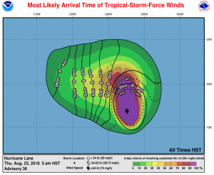
Because the storm has slowed its forward motion, the arrival time of damaging winds in Hawaii has been delayed. Tropical storm force winds shouldn’t strike south Hawaii until after 2pm today (7pm ET) and north Hawaii until after 8pm (2am ET.)