Just in time for the start of spring, a multi-day severe weather outbreak is expected to unfold over portions of the southern United States this week. According to the National Weather Service’s Storm Prediction Center (SPC), several tornadoes, including the potential for a few strong tornadoes, along with very large hail and damaging winds are expected over the next several days.
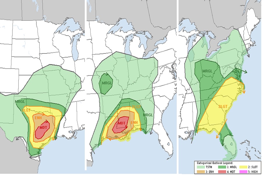
Today, thunderstorm coverage and intensity is expected to increase through the remainder of the afternoon into the early evening, from northwest into central Texas, with all severe hazards possible. Beyond large damaging hail, violent tornadoes, and straight line wind damage, these storms could include dangerous frequent lightning and heavy downpours which could create isolated flash flood conditions.
The SPC warns that a couple of longer-track supercells may initiate across parts of central Texas late this afternoon and move northeastward, posing a threat of tornadoes and very large hail, with a couple of strong tornadoes possible. “Storm modes are expected to become more linear late tonight, but a threat of damaging winds and a few tornadoes will likely persist into the Ark-La-Tex and southeast Texas into Tuesday morning,” the Storm Prediction Center said in a Convective Outlook update today.
The severe weather will shift east tomorrow, with the highest probability of severe weather expected over east central Louisiana and west central Mississippi. A broader threat area of severe storms will stretch from eastern Texas to western Georgia. On Tuesday, the threats of large hail, destructive winds, and violent tornadoes will persist.
On Wednesday, the threat of severe weather will shift to the east coast, with the threat of severe thunderstorms from Delaware south to central Florida. The greatest threat of severe storms on Wednesday should be between the Florida panhandle and the Outer Banks of North Carolina; however, as the storm system evolves, the SPC will revise their Convective Outlook to include the latest data.
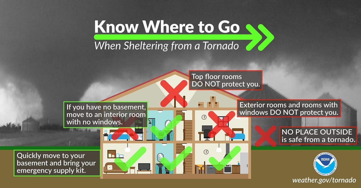
People within the danger zones should become familiar with their surroundings and what they should do if a Severe Thunderstorm Watch or Warning or if a Tornado Watch or Warning are issued for their county or parish. While Severe Thunderstorm and Tornado Watches are often issued an hour or a few hours before a severe weather threat arrives, Warnings may only be issued moments before a storm impacts a specific area.
