The Aloha State has had more than its fair share of natural disasters this year. In April, a freak rain storm brought a record-breaking amount of rainfall to Kauai’s north shore. More than 4 feet of rain fell in a matter of hours, washing away roads and homes in the process. The same freak weather event soaked Oahu, creating major flooding there too. The flood was to be the first of a relatively long line of disasters to strike Hawaii in recent months.
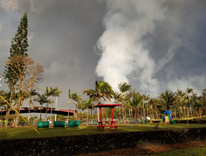
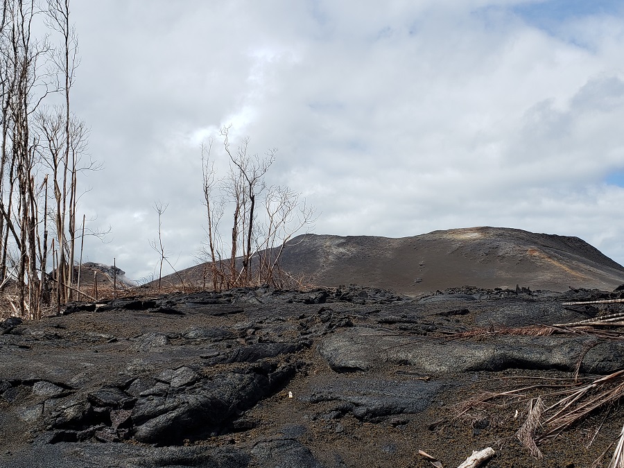
After the April 15 flood, multiple disasters struck Hawaii’s Big Island. On May 3, significant cracks began to appear in the residential neighborhood of Leilani Estates, filling with steam and eventually lava by the end of the day. The next day, two homes were destroyed in spreading lava. Within days, more than 1,700 people were evacuated as the 2018 Lower East Rift Zone eruption from Kilauea began in earnest. While lava was coming out of the Lower East Rift Zone, ash was flying high at Kilauea’s summit. By mid May, the Honolulu office of the National Weather Service crafted new advisories related to volcanic ash after explosions rocked the summit.
The ongoing eruption filled Hawaii Island’s air with toxic gas. Known as “vog”, the brown haze filled with volcanic gasses spread well beyond Hawaii over time. At the end of May, the bad air from Hawaii was impacting the quality of air at locations far away, including the island of Guam.
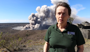
From May into August, thousands of earthquakes shook the island, bringing about damage in the towns of Volcano Village, Pahala, and Ocean View. Also severely damaged: Hawaii Volcanoes National Park, which shut down due to safety concerns on May 11. Most of the park, excluding the Kahuku Unit, has been shuttered to guests as frequent earthquakes have damaged buildings, destroyed roads, and ruined infrastructure such as water service.
#Wildfire as wide as the eye can see: huge fire burning through scrub and brush above #Waikoloa. Sky glowing orange just as it does on lava field on eastern side of the island. Doesn’t look good. #HIwx pic.twitter.com/EyLqkk4136
— the Weatherboy (@theWeatherboy) August 2, 2018
As if the near constant earthquakes, threats of volcanic explosions, and ongoing erupting lava weren’t enough, Hawaii’s next natural disaster to deal with would be wildfire. Nearly 20,000 acres burned near Waikoloa on the Big Island’s west coast, making it the second largest fire in Hawaii’s history. Fortunately, there were no injuries and no structures were damaged nor destroyed. With the island parched, more wildfires popped-up, including in Hawaii Volcano’s National Park on the slopes of Mauna Loa a few weeks later.
As #wildfire burns near @Volcanoes_NPS , smoke is lowering visibility on Highway 11. Smoke is so thick and air is so acrid we put on respirator meant for SO2 in #KilaueaEruption area. #HurricaneHector may be gone, but stay safe nevertheless! #HIwx pic.twitter.com/PO8VVFgwnA
— the Weatherboy (@theWeatherboy) August 8, 2018
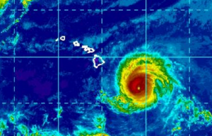
After the fires, the hurricanes came. The first of the bunch was Hurricane Hector. Once a potent Category 4 storm, the anular storm fortunately traveled just south of Hawaii’s Big Island. While rough surf battered the state, especially south and east facing shores of Hawaii Island, impacts from wind and rain were negligible. After that early August threat, another tropical cyclone approached Hawaii at the end of the month. This second storm was Hurricane Lane. This storm took an unusual path up over the off-shore waters of Hawaii’s west coast, then went west, traveling south of Maui, Oahu, and eventually Kauai. Unlike Hector, Lane was close enough to Hawaii to do substantial damage. Lane was eventually followed by Olivia.
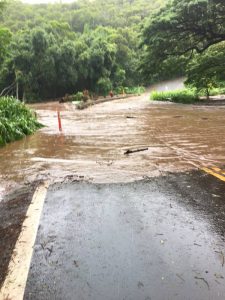
Heavy rain makes navigating main road through #Pahoa #Puna difficult now on Hawaii. #TropicalStormLane #HurricaneLane #HIwx pic.twitter.com/D6xKIU6wuH
— the Weatherboy (@theWeatherboy) August 26, 2018
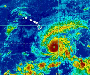
Hurricane Lane broke records in Hawaii. Mountain View received a preliminary total of 52.02 inches, which ranks as the highest rainfall total from a tropical cyclone in Hawaii’s recorded history. 1950’s Hurricane Hiki held the previous record with 52.00″. Drenching rains also reached other islands, producing flood damage beyond Hilo which was hit the hardest.
The third and most recent storm to strike Hawaii was Olivia. Also once a category 4 hurricane, Olivia weakened as it approached the islands. While the previous storms hit Hawaii the hardest, Olivia hit Maui the worst. For the first time in recorded history, a tropical storm struck Maui. While the Big Island saw flooding rains, they weren’t nearly as bad as they were with Lane. Unfortunately for Maui, floods did wash away roads and cars and fill communities with brown water.
While Hawaii was preparing for the busy hurricane season, the volcano started to take a break. Most earthquakes stopped at Kilauea’s summit while lava stopped flowing in the Lower East Rift Zone. By August 15, USGS scientists considered the 2018 eruption event “paused”. While USGS has declared the current eruption “paused”, they haven’t declared it over, suggesting that lava could return at any time. In a previous eruption event, lava paused for more than 3 months before returning.
The pause was welcomed by the community and the USGS scientists tracking the ongoing volcanic disaster. But even during the pause, USGS scientists are busy evaluating what’s what with Kilauea; the frequent tropical cyclone activity didn’t make it easy.
USGS Geologist Janet Babb described to us the impacts the tropical cyclones had on their efforts. “During Lane and Olivia, USGS staff were not in the field during the height of the storms, but were ‘on call’ which meant that if any significant changes had been noticed via our monitoring instruments, staff were at the ready to respond. ” Fortunately, the storms had little impact on USGS Hawaii Volcano Observatory (HVO) equipment. “During Hurricane Lane, HVO lost a summit tiltmeter and telemetry switch. But thanks to redundancies built into our network, we were never in the dark, so there was no interruption in our monitoring capabilities. The damaged instrumentation is now repaired, ” Babb said.
The storms, including the deluge that came with Lane, had minimal impacts to the volcano and its flow field too. “Effects of torrential rainfall on Kilauea Volcano’s lower East Rift Zone lava flow during Lane was minimal. Where the interior of the flow was still hot, heavy rain resulted in the formation of steam. In some places on the flow field, it is possible that enough steam was produced to generate ‘white-out’ conditions,” Babb added. A white-out in steam is when it is so thick visibility is greatly reduced. As far as the summit, Babb said, “The greatest effect of heavy rainfall was slope stability issues. The crater walls were already unstable due to the earlier earthquake activity and collapses that occurred between mid-May and early August, so heavy rain further loosened crater wall material, causing minor rock slides on the unstable slopes.”
Hawaii Volcanoes National Park spokesperson Jessica Ferracane echoed Babb’s sentiment that the tropical cyclones fortunately had little impact to the park. There was even positive impact; “the rains did assist in suppressing the fire as did the hard work of the teams of firefighters both from the park and mainland agencies,” Ferracane told us via email. “To my knowledge, Hurricane Lane resulted in little delay to the park’s recovery efforts. The NPS (National Park Service) geomorphologist had to postpone his trail observations for about half a day, and HDOT (Hawaii Department of Transportation) likely suspended their patchwork and assessments on Highway 11 for a bit, but no real measurable setbacks due to the storms.”
September 2018 tour inside the Mandatory Evacuation Zone in Leilani Estates.
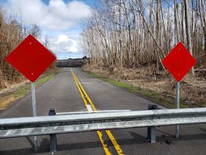
With the volcanic eruption paused and no significant ongoing earthquake activity occurring, some sense of normalcy is returning to Hawaii. On September 7, Hawaii County Mayor Harry Kim lifted the Mandatory Evacuation Order that was in place for Leilani Estates, ground zero for the Lower East Rift Zone eruption. Since then, some more access has been granted to residents to explore some areas that were previously closed due to the eruption. However, a large part of Puna remains unreachable and a voluntary evacuation request remains in effect.
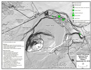
The island’s largest tourist attraction is also reopening: Hawaii Volcanoes National Park will re-open a limited portion of the park in time for National Public Lands Day on Saturday, September 22. “We are thrilled to welcome our public back and share the incredible changes that have taken place,” said Superintendent Cindy Orlando. “We ask that you stay alert to these profound changes while enjoying your park and its resources.” The park is scheduled to open at 10am for the first time since its May 11 closure. However, many high-profile areas such as a Thurston Lava Tube and the Jagger Museum will remain closed. one sight which will be available for viewing, though, is the Hōlei Sea Arch. Despite the thousands of earthquakes that struck the region and fears it would crumble into the sea, it is still standing as of this writing.
While there is a sense of normalcy returning, people are also cautiously monitoring what the future could bring. While the eruption has paused, there has been an uptick in earthquakes greater than 3.0 on Hawaii in the last few days, including a 3.5 that struck this morning. Some forecast model guidance, such as the overnight run of the European ECMWF, continue to suggest that yet another tropical cyclone could have direct or indirect impacts on Hawaii in about a week. Despite soaking rains from previous tropical cyclones, some parts of the islands are becoming very dry again and the Hawaii Wildfire Management Organization cautions wildfires could happen at anytime throughout the year.