The National Hurricane Center in Miami, Florida is keeping a close eye on a disturbance currently located in the open waters of the Atlantic Ocean for any signs of tropical cyclone development.
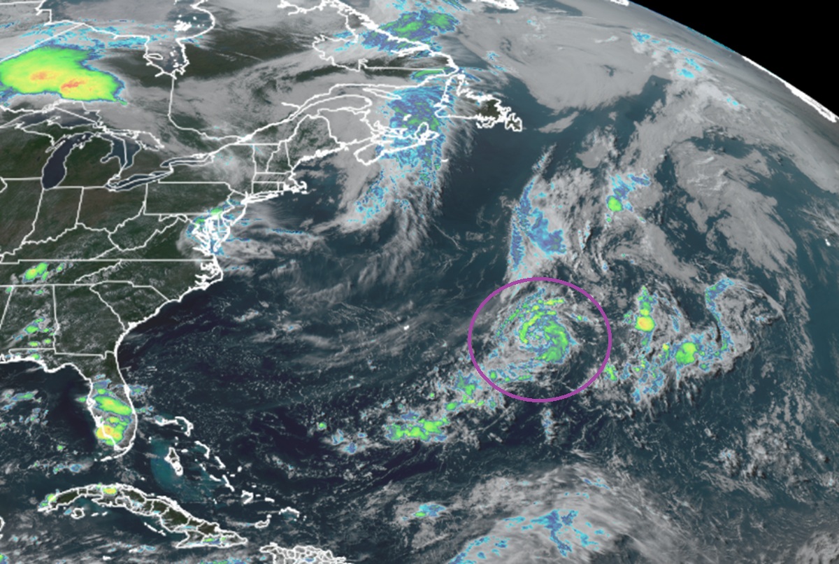
According to the latest Tropical Outlook issued by the National Hurricane Center (NHC), satellite data indicates that a weak low pressure system has formed about 450 miles east-southeast of Bermuda.
“The associated showers and thunderstorms remain disorganized, but some slow development is possible during the next day or so while the low moves northeastward over the central Atlantic,” the NHC says.
However, by Monday night, the system is expected to move over cool waters and into a region of strong upper-level winds, ending its opportunity for development. Because of this scenario where it’ll become increasingly hostile for a tropical cyclone to form, the NHC says there’s only a 20% chance of tropical cyclone formation over the next 48 hours.
Elsewhere the Atlantic Hurricane Basin remains very quiet with no other areas being monitored for possible tropical cyclone development. The NHC says the basin should remain free of tropical cyclones through at least the next 7 days.
The Atlantic Hurricane Season began on June 1 and runs through November 30. There have been no tropical storms or hurricanes in the basin yet this year.
