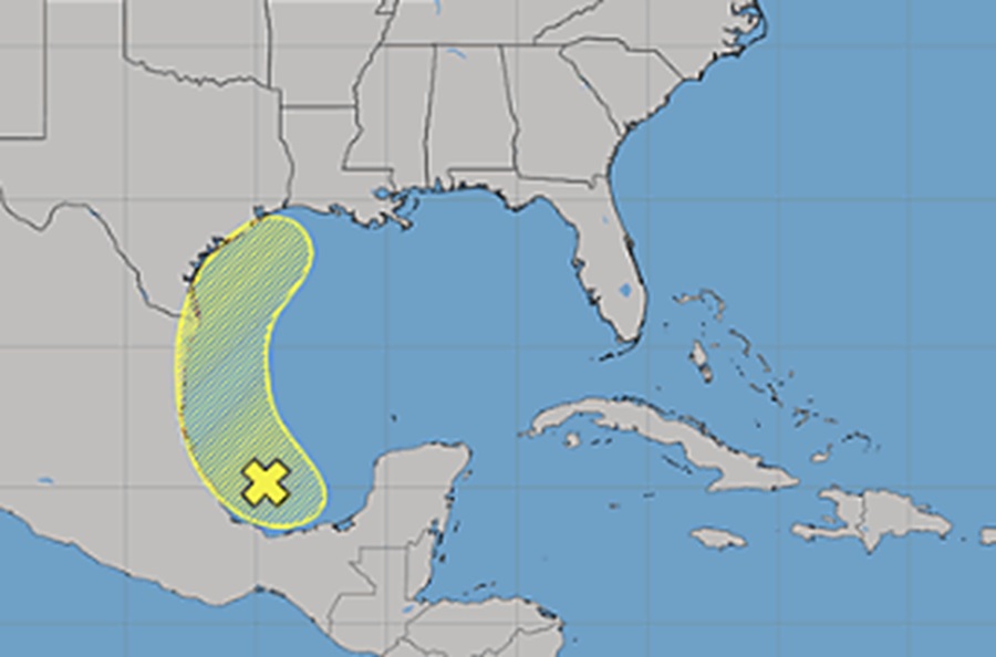
The National Hurricane Center is closely monitoring an area of disturbed weather in the Bay of Campeche. As it moves north and east towards the Mexican and Texas coasts in the Gulf of America, there’s growing concern it could develop into a tropical cyclone in the coming days.
Right now, disorganized shower and thunderstorm activity has increased a little near a broad area of low pressure located over the Bay of Campeche. According to the National Hurricane Center (NHC), environmental conditions are forecast to be only marginally conducive for development before the system moves inland over eastern Mexico late Saturday or Sunday.
“The system could re-emerge over the northwestern Gulf on Tuesday and Wednesday while interacting with a frontal boundary, but there too, conditions are only expected to be marginally conducive for any development,” said the NHC in their latest Tropical Outlook.
While odds remain low of development, the NHC has doubled their odds from yesterday, now saying there’s a 20% chance of tropical cyclone formation here.
Computer forecast guidance continues to share different opinions, with some showing the formation of a named tropical storm off the Texas Coast by early in the new week.

The 2026 Atlantic Hurricane Season began on June 1; there has yet to be any tropical cyclone activity in the basin yet. Should a tropical cyclone develop and become a named tropical storm, it would be given the first name of the 2026 list: Arthur.
Beyond the National Hurricane Center, local National Weather Service offices are closely monitoring the system too. In Galveston/Houston, the local National Weather Service says even if a tropical cyclone doesn’t take shape, soaking rains will. They share in their latest Forecast Discussion that “an influx of moisture from the tropical disturbance forming in the Bay of Campeche tracking northward through the weekend should provide better shower/storm chances/coverage going through the weekend.” They add, “The subtropical ridging will gradually weaken going into early next week, as a mid-level trough deepens across the Plains. Timing of a frontal passage with this trough has come into much better agreement amongst ensemble guidance, thus the bulk of widespread rainfall looks to be more in the Monday to Tuesday timeframe.”
Meteorologists at both the National Hurricane Center and National Weather Service will continue to track the disturbance as it moves through the Gulf of America and will issue advisories, watches, or warnings as necessary. Until then, they are in “wait and see” mode.
