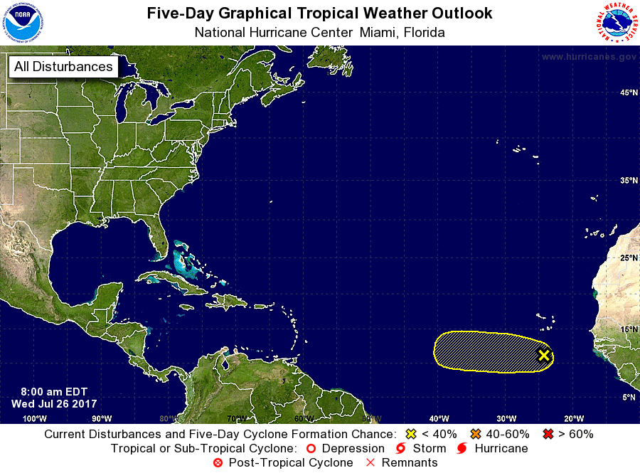
The National Hurricane Center (NHC) is monitoring a new disturbance, fresh off the coast of Africa. In their latest five day outlook, the NHC gives this disturbance a low chance for developing into a tropical cyclone over the next five days, but conditions could become more favorable over time as it marches west over the open waters of the central North Atlantic.
This morning, a few showers and thunderstorms south of the Cabo Verde Islands are associated with the tropical wave moving westward at 10 to 15mph. The NHC says development of this system, if any, will be slow to occur, saying there’s a zero chance of formation over the next 48 hours and only a 20% chance over the next five days.
Elsewhere across the tropics, the Atlantic Hurricane Basin is quiet with no other areas being monitored for development.
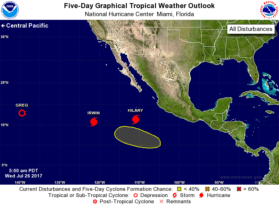
The opposite is true for the Pacific, where the National Hurricane Center is tracking three named systems and an additional area that may grow into the next tropical cyclone there.

Tropical Depression Greg is the most west of the bunch and is due to enter the domain of the Central Pacific Hurricane Center in Honolulu, HI today. Greg is roughly 1,000 miles east of Hilo, HI; once it moves beyond 140W, responsibility for issuing advisories shifts from the National Hurricane Center to the Central Pacific Hurricane Center.
Hurricanes Irwin and Hilary continue to spin about in the Pacific and currently pose no immediate threat to land.
An area of possible development exists south of Hurricane Hilary. An area of low pressure could form several hundred miles south of Mexico in a day or two here. Development, if any, of this system is expected to be slow to occur during the next few days due to strong upper-level winds. These winds might become more conducive for some development this weekend as Hurricane Hilary moves farther away from the disturbance. This system is expected to move west-northwestward at 5 to 10 mph during the next several days.