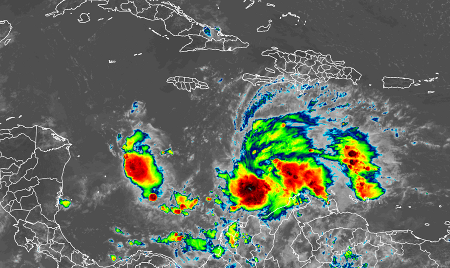
The 31st tropical depression of a record-breaking Atlantic hurricane season has formed in the Caribbean and the National Hurricane Center is warning that it will become a hurricane in the coming days.
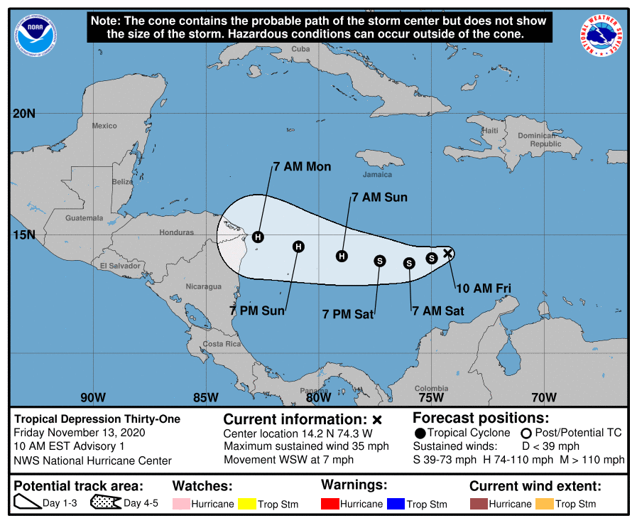
.The newly formed tropical depression is located at 14.2N, 74.3W, which puts the center roughly 310 miles south-southeast of Kingston, Jamaica. With maximum sustained winds of 35 mph, the minimum central pressure is down to 1007 mb or 29.74″.
The National Hurricane Center believes this storm will intensify in the coming days as it moves west towards Central America. Right now the depression is moving toward the west-southwest near 7 mph and this motion is expected to continue through early Saturday. A westward to west-northwestward motion at a slightly faster forward speed is expected to begin by late Saturday and continue through early Monday. On the forecast track, the system will move across the central Caribbean Sea during the next day or so, and approach the coasts of Nicaragua and northeastern Honduras late Sunday and Monday. This is the same region hit hard by Hurricane Eta just days ago.
While maximum sustained winds are only 35 mph now, the depression is forecast to strengthen into a tropical storm later today or tonight. Additional strengthening is likely over the weekend, and the system could be near major hurricane strength when it approaches Central America with maximum sustained winds greater than 110 mph.
To make matters worse, computer forecast guidance is suggesting that an additional tropical cyclone could form in this system’s wake, producing more misery for the people of Central America.
When Tropical Depression #31 is upgraded to a tropical storm, it will be named after the Greek alphabet letter “Iota.” There has never been this many named storms in the Atlantic Hurricane Basin ever on record and the name Iota was never used before, joining Eta and Theta as first-time storm names.

Even before this system approaches Central America, there could be problems in the Caribbean. This system is expected to produce 4-8″ of rain, with local 12″ totals, across portions of northern Columbia, Panama and Costa Rica. Across Jamaica and southern Haiti, 2-4″ are expected, with local amounts up to 6″. Across remaining sections of Central America, the system has the potential to produce 20-30″ of rain with a focus across northern Nicaragua and Honduras. This rainfall would lead to significant, life-threatening flash flooding and river flooding, along with landslides in areas of
higher terrain.
With significant infrastructure damage in Nicaragua and Honduras from Eta, there’s a risk that many people won’t be aware of this new life-threatening threat arriving in the coming days. Efforts are being made now to share the news so people can seek safe shelter on higher ground.