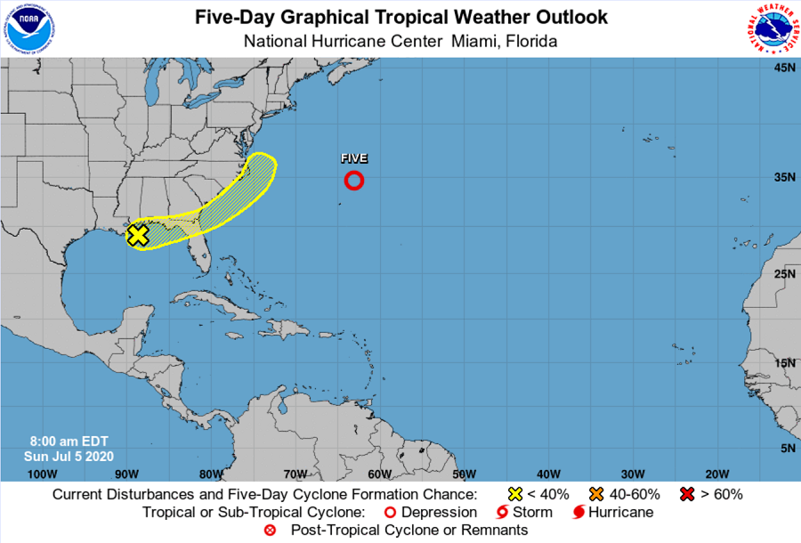
The National Hurricane Center is monitoring for the possibility a tropical cyclone could form along the U.S. east coast, perhaps impacting the metro New York City / New Jersey area by the end of the upcoming week.
A broad area of low pressure located along the northern Gulf Coast is producing disorganized showers and a few thunderstorms from eastern Texas to northern Florida. According to the National Hurricane Center in Miami, Florida, some slight development of this system is possible before the disturbance
moves onshore along the northeastern Gulf Coast on Monday. Eventually, this system is forecast to move northeastward and could emerge offshore of the Carolinas later this week. At that time, the National Hurricane Center believes conditions could be conducive for additional development.
For now, the National Hurricane Center believes there’s only a 10% chance that a tropical cyclone will develop over the next 48 hours but those odds grow to 30% within the next 5 days. Computer forecast models that meteorologists use to aid in their forecasting suggest a system could take shape by the middle to later part of the week; both the American GFS and European ECMWF forecast models have suggested such. If the latest runs of the forecast models are correct, a better organized system could impact the New York City / New Jersey metro area by Friday or Saturday.
While it remains too early to say with any degree of certainty what will become of this system, it is important that people remain weather aware and storm ready. The Atlantic Hurricane Season runs through November 30 and it is possible for tropical cyclone formation to occur anytime from now to the season’s end.