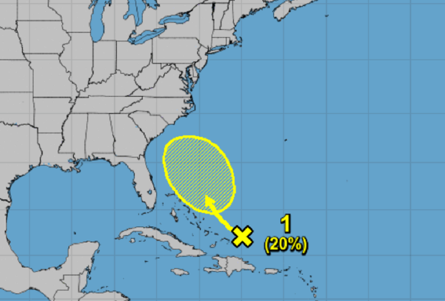
Just a day after their Tropical Outlook was hopeful there’d be no tropical cyclone development within the Atlantic Hurricane Basin, the National Hurricane Center (NHC) has issued a new outlook pointing out the possibility of new tropical cyclone development along the U.S. East Coast in the coming days.
For many days, computer forecast guidance has suggested that as Major Hurricane Sam curves away from the U.S. East Coast, there could be an opportunity for an area of low pressure, perhaps a tropical low, to form somewhere between the Florida Straits and the Bahamas. That guidance has been inconclusive at best, with different low centers suggested but none actually forming.
However, now, there’s a large area of disorganized cloudiness and showers over the southeastern Bahamas and adjacent southwestern Atlantic waters. This area is associated with a surface trough in the region. According to the National Hurricane Center, upper-level winds are expected to be only marginally conducive for further development and any such development would be slow to occur. The area of concern will gradually drift west-northwest no faster than 10 mph through tomorrow, followed by an even slower northwest motion through the end of the week.
The NHC still believes chances of development of this system are low for now. There’s a 10% chance of tropical cyclone formation over the next 48 hours and those odds grow to 20% over the next five days. Because of how close it is to the United States, National Weather Service offices on the east coast will closely monitor it as will the National Hurricane Center in Miami, Florida.