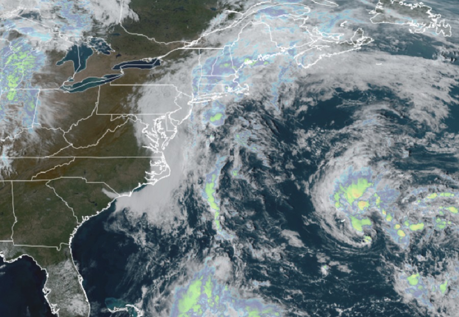
The National Hurricane Center (NHC) now says it is likely a tropical cyclone is forming near Bermuda in the Atlantic Ocean; it is possible this system could make its way to the U.S. or Canadian East Coast in the coming days. Just yesterday, the NHC said there was only a 10% chance that a system would form; now, they’ve upped those odds to a “high” 70%.
In their latest Tropical Outlook, the NHC says satellite and Bermuda radar images indicate that the low pressure system located about 100 miles east-southeast of Bermuda now has a well-defined center and is producing a relatively concentrated area of showers and thunderstorms. “If the thunderstorm activity persists near the center, the disturbance will likely become a tropical depression later today or tonight while it moves
west-northwestward and passes near Bermuda,” the NHC warns.
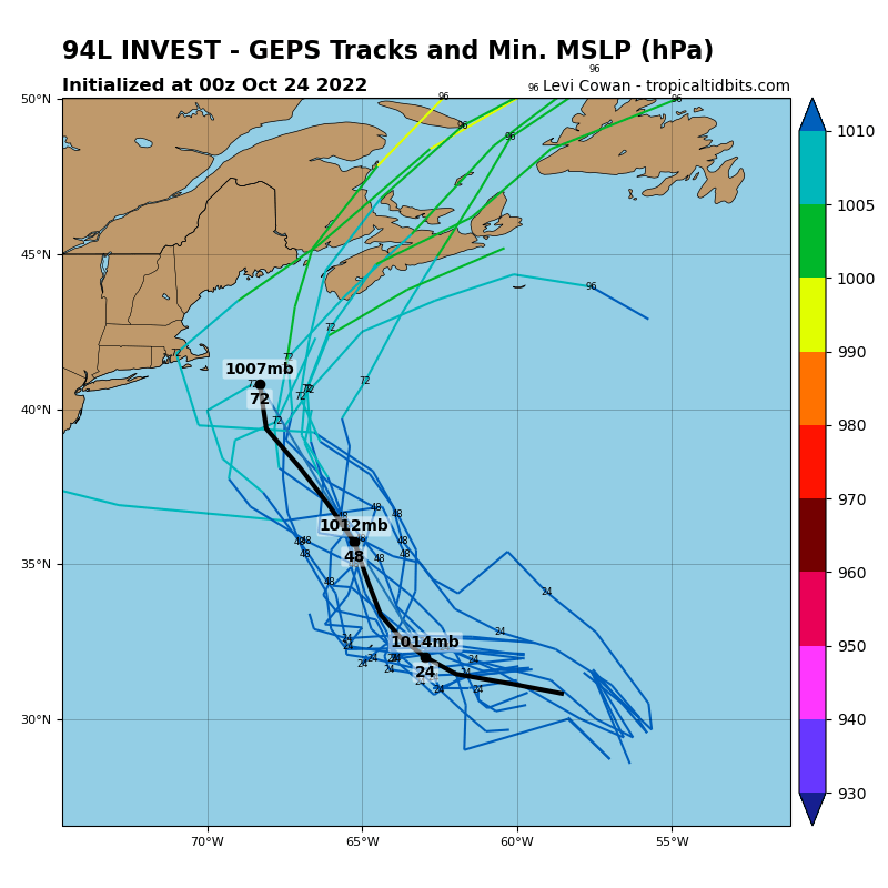
After that time, the system is expected to turn northward and move toward cooler waters and into a region of unfavorable upper-level winds, which should limit additional development. Forecast models suggest the system could impact portions of the New England coast or the Canadian Maritimes with time and people in those areas should continue to monitor the future track of this disturbance. Atlantic Canada continues to recover from a devastating impact from Hurricane Fiona just weeks ago.
Even if development into a tropical cyclone doesn’t happen in the short-term, periods of locally heavy rainfall and gusty winds are expected over Bermuda through tonight. “Interests in Bermuda should monitor the progress of this system,” cautions the NHC.
The National Hurricane Center is also monitoring another disturbance in the southwest Atlantic Ocean. An area of low pressure is expected to form north of Puerto Rico over the southwestern Atlantic in a few days. Thereafter, environmental conditions appear conducive for gradual subtropical development of this system while it meanders over the southwestern Atlantic through the early part of the weekend. While formation isn’t expected over the next 48 hours, the NHC says there is a 30% chance of formation over the next 5 days.
