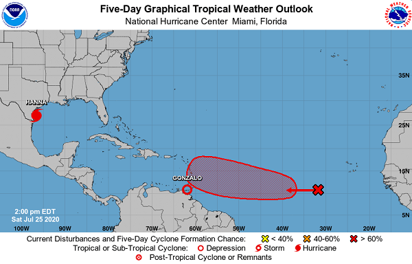
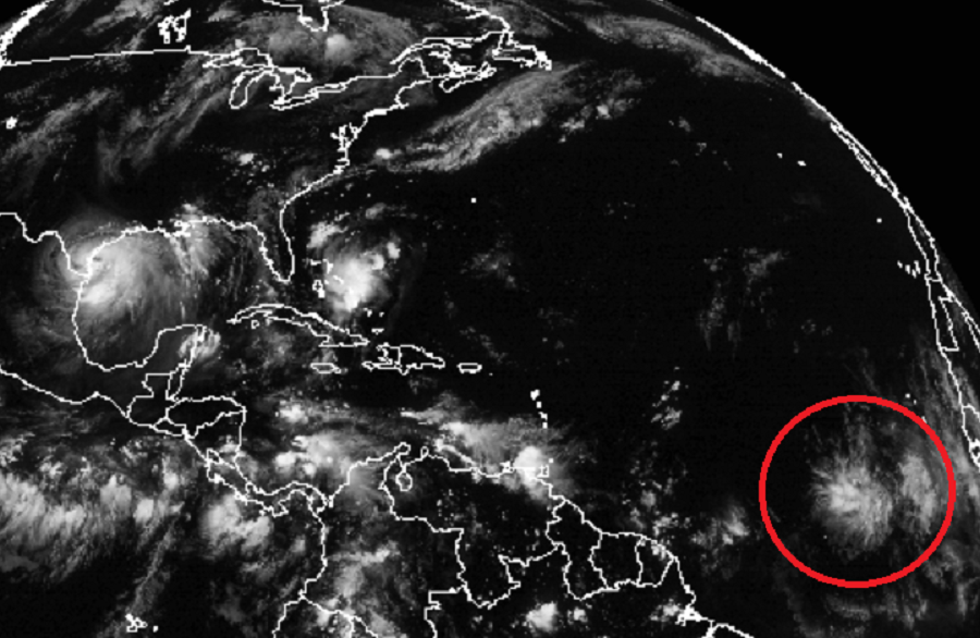
While the U.S. is bracing for impacts from Hurricanes Hanna and Douglas, it appears another could be on the way. While Tropical Depression Gonzalo fizzles away, a robust system that moved off of the Africa coast just days ago is starting to look impressive on satellite photography.
According to today’s Tropical Outlook from the Miami-based National Hurricane Center, a tropical wave is producing a broad area of cloudiness and disorganized showers and thunderstorms several hundred miles southwest of Cabo Verde Islands. The wave is expected to move westward at about 15 mph during the next several days, and a tropical depression is likely form early next week when the system reaches the central tropical Atlantic. The National Hurricane Center gives this system a 70% chance of developing into a tropical cyclone over the next 5 days.
Computer model forecast guidance suggests additional development beyond that point, with a strong tropical storm or hurricane likely by next weekend. Some guidance also suggests a possible eventual landfall on the U.S. coastline, but such a scenario is so far into the future confidence is low on such a forecast.
Should this storm become a tropical storm, it would be named Isaias.
As is the case any time during hurricane season, which runs from June 1 to November 30 in the Atlantic, people should keep an eye on these storms and be prepared for their potential impacts well before they arrive.
