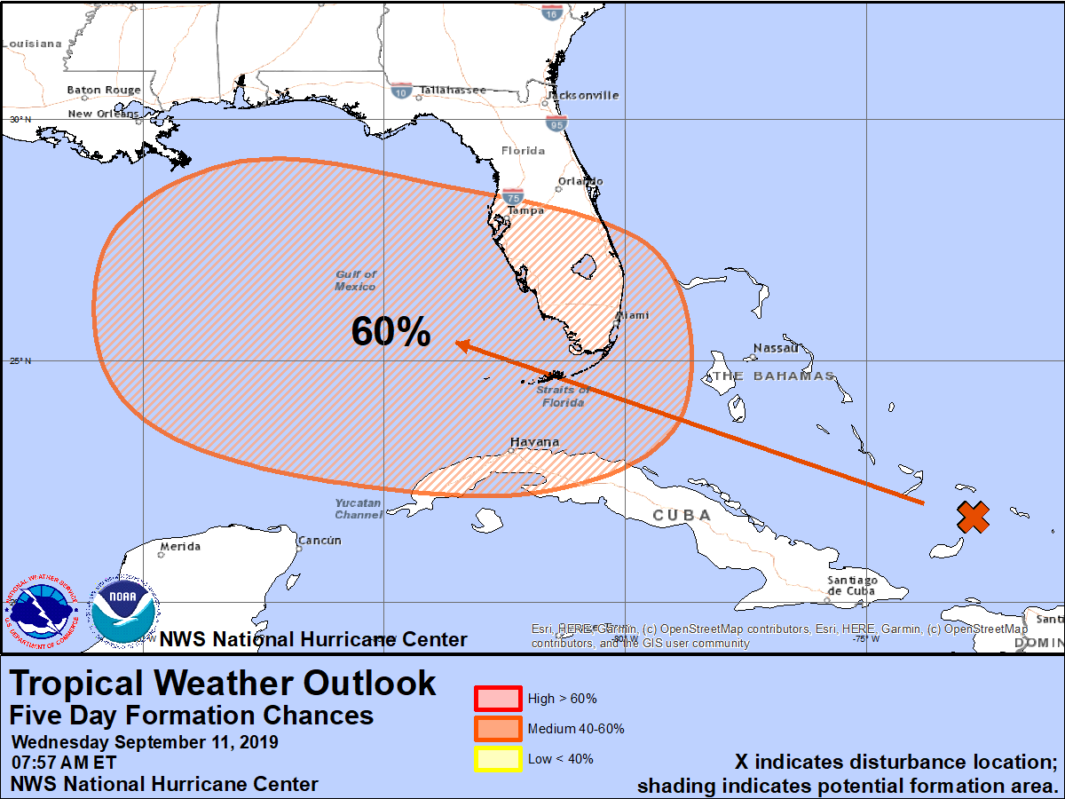
The National Hurricane Center believes a new tropical cyclone could be forming near the Bahamas, giving the area of disturbed weather a 60% chance of becoming one within the next 5 days. This system is one of three the National Hurricane Center is tracking in the Atlantic hurricane basin. Yesterday was the traditional peak of the Atlantic hurricane season and the next two weeks typically feature more activity than other weeks in the season.
The area of concern today is a large area of showers and thunderstorms located along a sharp surface trough from near eastern Cuba through the southeastern Bahamas into the southwestern Atlantic. According to the National Hurricane Center, conditions are forecast to become more favorable for development late this week, and a tropical depression could form near the northwestern Bahamas or South Florida as early as Friday. Further development is possible over the eastern Gulf of Mexico later this weekend. The disturbance will likely produce periods of locally heavy rainfall and gusty winds across the Bahamas through Friday, and across Florida during the weekend.
People in Florida, the Bahamas, the the Gulf Coast should monitor evolving forecasts as this system takes shape.
The other systems the National Hurricane Center are tracking are over the central Atlantic and are not expected to become tropical cyclones in the next 2-5 days.
