A new tropical cyclone is forming near Florida and the National Hurricane Center is urging people in the Sunshine State and the Gulf Coast to prepare for its impacts. The National Hurricane Center now believes there’s an 80% chance that a tropical cyclone will form in this region in the coming days. This area of likely development comes a day after the traditional peak of the Atlantic hurricane season.
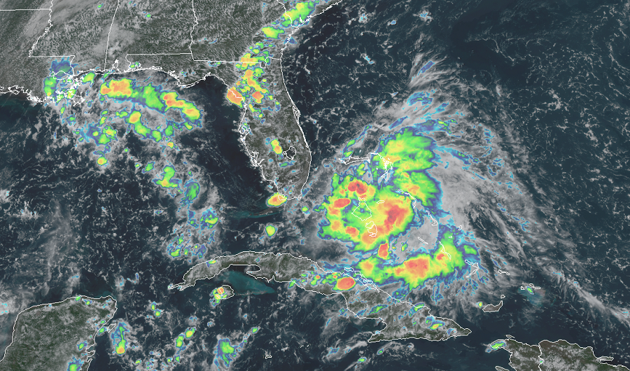
This afternoon, shower and thunderstorm activity located over the northwestern and central Bahamas and the adjacent waters continues to shows signs of organization. In addition, surface observations indicate that pressures have fallen over the area since yesterday and, along with wind and satellite data, suggest that a broad area of low pressure could be forming between the northwestern Bahamas and South Florida. According to the National Hurricane Center in Miami, Florida, this system is forecast to move westward at about 10 mph, and it could become a tropical depression while it is near south Florida tonight. If the system doesn’t become a tropical depression tonight near south Florida, it would likely become one as it moves slowly west-northwestward over the northeastern Gulf of Mexico this weekend and early next week.
Regardless of development, this system is expected to produce locally heavy rainfall over portions of the Bahamas, South Florida, and the Florida Keys during the next couple of days, and interests there, as well as along the northern and eastern Gulf coast, should monitor its progress. Even if the system doesn’t reach tropical depression status, the rain it drops could still create local flooding problems. The National Weather Service cautions: turn around, don’t drown; never drive through flood waters.
The next tropical storm of the 2020 Atlantic Hurricane Season will be named Sally. As such, if this system develops into a tropical storm, it would be called Sally. If that were to happen, it would be the earliest “S” storm on record. To date, the earliest an “S” storm has formed is October 2 in 2005; that was Tropical Storm Stan.
