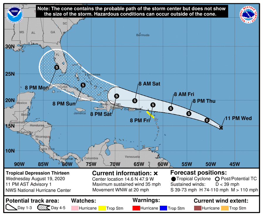
The National Hurricane Center (NHC) in Miami, Florida has begun issuing advisories on the newest tropical cyclone in the Atlantic: Tropical Depression #13. The government of the Netherlands has issued a Tropical Storm Watch for Saba and St. Eustatius in response to the NHC forecast that this cyclone will strengthen into a Tropical Storm. When it becomes a Tropical Storm, it will be named “Laura” and will become the earliest “L” storm in the Atlantic basin on record, breaking the record set by “Luis” on August 29, 1995.
A Tropical Storm Watch means that tropical storm conditions are possible within the watch area, generally within 48 hours. The NHC warns that interests elsewhere in the northern Leeward Islands, the Virgin Islands, and Puerto Rico should monitor the progress of this system, as tropical storm watches could be required for those areas on Thursday.
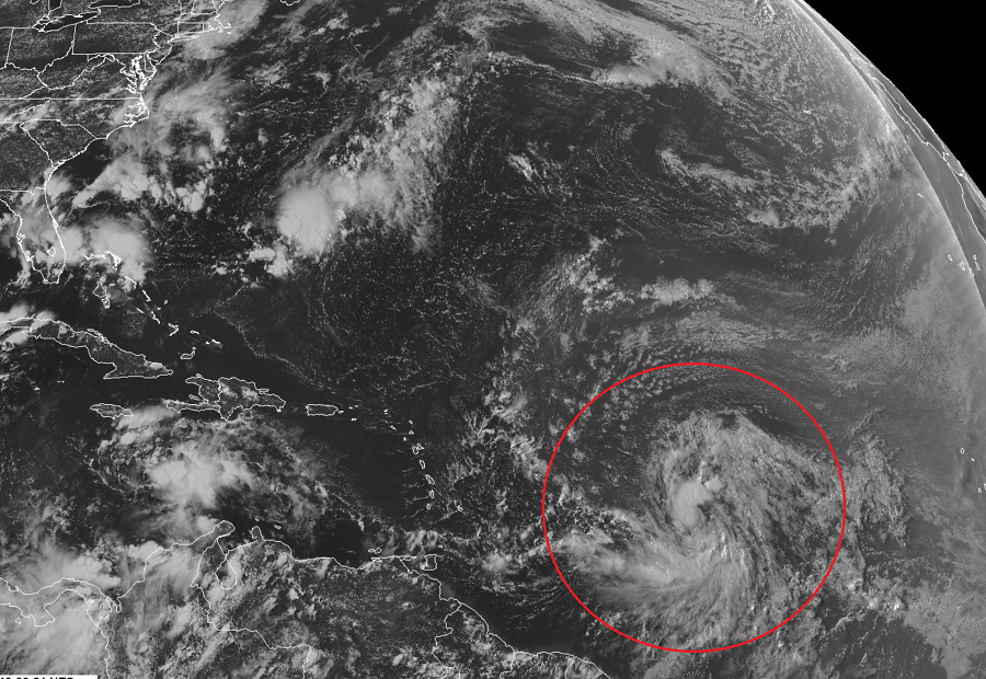
As of the 11pm ET advisory, the center of Tropical Depression Thirteen was located near latitude 14.6 North, longitude 47.9 West. Maximum sustained winds are near 35 mph with higher gusts. The estimated minimum central pressure is 1008 mb or 29.77 inches.
For now, the depression is moving toward the west-northwest near 20 mph. The NHC expects this general motion and speed to continue for the next few days. On the forecast track, the depression is expected to move near or north of the northern Leeward Islands by late Friday and near or north of the Virgin Islands and Puerto Rico on Saturday.
Beyond Saturday, it is possible this system could make direct impacts to the Bahamas, Cuba, and/or Florida. However, it is too early to say what those impacts will be or precisely where they’ll be. Residents in the path of this storm, including those in the southeastern United States, should make sure they have a Hurricane Action Plan in order before this storm arrives.
For now, the depression is expected to produce 1-3″ inches of rain with isolated maximum totals of 5″ through Friday night over the northern Leeward Islands and Puerto Rico. Tropical storm conditions are possible within the watch area by late Friday. Rough surf and rip currents will be possible around this system and those ocean conditions may last for many days.
A tropical cyclone is the generic term for a non-frontal synoptic scale low-pressure system over tropical or sub-tropical waters with organized thunderstorm activity and a definitive cyclonic surface wind circulation. In waters around the United States, tropical cyclones begin as tropical depressions. Once a tropical depression’s maximum sustained winds grow to 39 mph, the system is classified as a “tropical storm” and is given a name from the list of storm names the NHC uses each year. Once maximum sustained winds reach 74 mph, the system is re-classified as a “hurricane.” If winds reach or exceed 110 mph, the system is known as a “major hurricane.”
