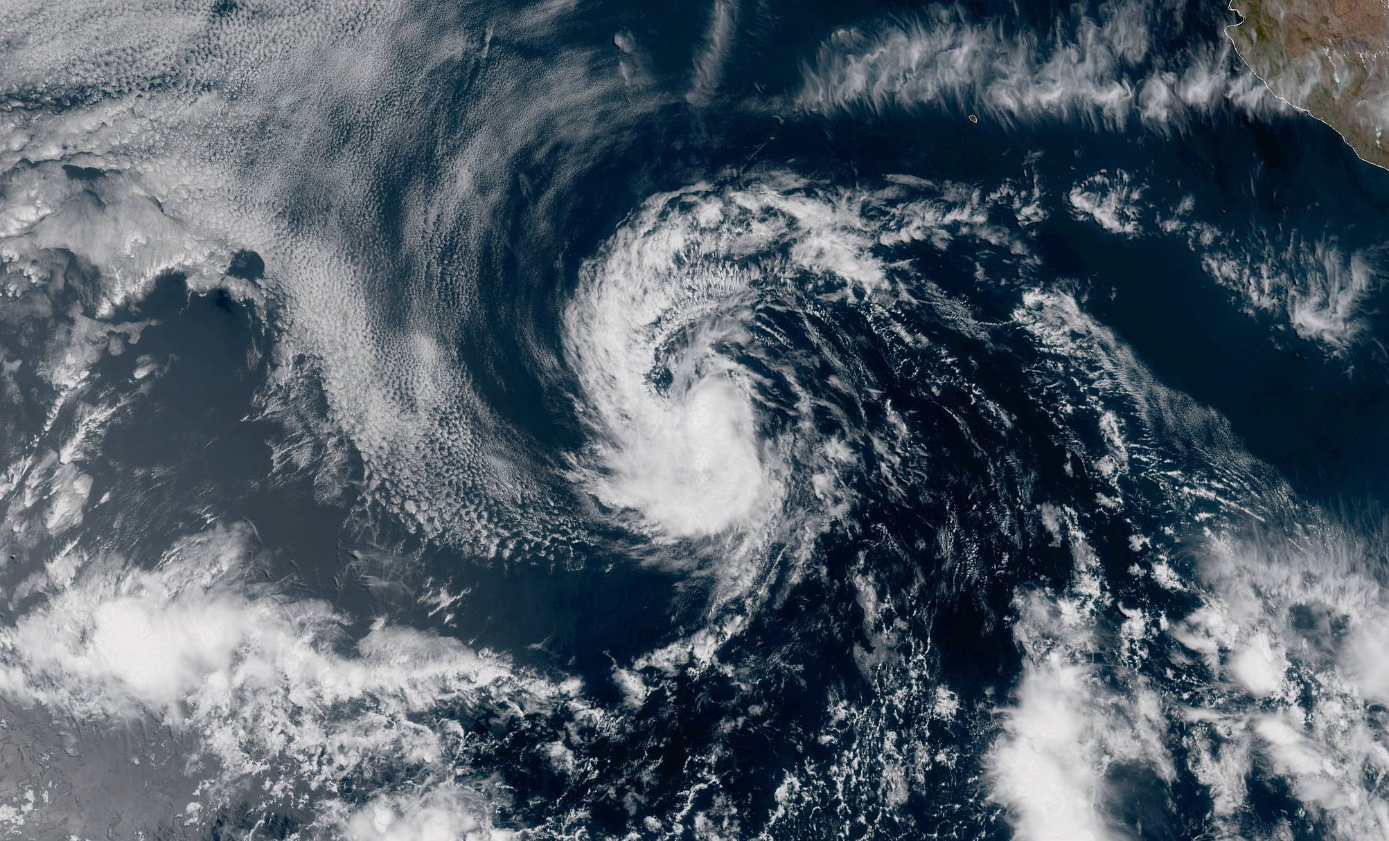
The National Hurricane Center in Miami, Florida has classified an area of disturbed weather in the eastern Pacific as Tropical Depression #1E, the earliest such a system has formed since the satellite observation era began in 1966.
Tropical Depression One-E was centered as of 2pm PT over the open waters of the eastern North Pacific Ocean about 740 miles (1190 km) southwest of the southern tip of Baja California. It’s moving toward the northwest near 7 mph (11 km/h). This general motion is expected through tonight, followed by a turn toward the west on Sunday. Maximum sustained winds remain near 35 mph with higher gusts.
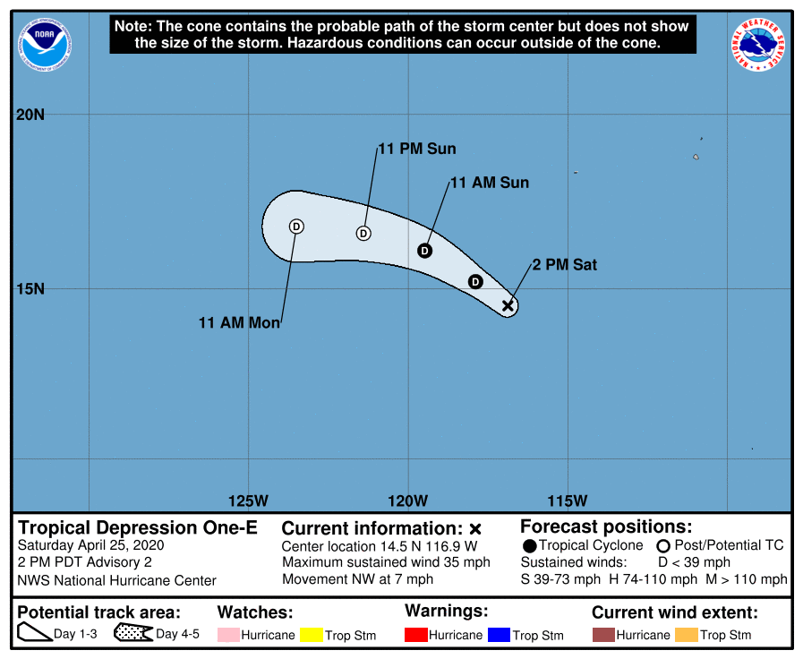
According to the National Hurricane Center, the overall organization of the depression has changed little since this morning. Its well-defined but exposed center is displaced north of the active convection. Since the organization of the cyclone is largely unchanged, the initial intensity pegged by National Hurricane Center meteorologists remains the same. They continue to predict that the storm will track generally northwestward today and tonight, and then turn westward on Sunday. Although it is not explicitly shown in the forecast, some minimal short-term strengthening is possible today and the system could briefly become a tropical storm.
However, a combination of dry air, increasing shear, and cooler sea surface temperatures should cause the system to weaken by tomorrow, and it will likely become a remnant low within 36 hours. The remnant low could then persist for another day or so before dissipating early next week. Little change in strength is anticipated today or tonight. The system is then forecast to become a remnant low by late Sunday. It is not a threat to land.
The National Hurricane Center in Miami, Florida, responsible for tracking and forecasting tropical cyclone activity in both the Atlantic and eastern Pacific basins, is issuing advisories for the storm.
According to National Hurricane Center scientist Eric Blake on , this disturbance is “highly anomalous” and is “over two weeks earlier than any tropical cyclone on record in that basin.”
The Eastern Pacific Hurricane Season runs from May 15 to November 30 while the Central Pacific Hurricane Season, which includes Hawaii, and the Atlantic Hurricane Season, which includes the U.S. Gulf and East Coasts, begin on June 1; they too run through November 30.
