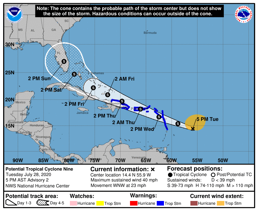
With the latest tropical cyclone in the Atlantic Hurricane Basin taking shape, the National Hurricane Center and other local government agencies have begun to issue warnings for those in the projected path of this storm. Known simply as Potential Tropical Cyclone #9 today, the system is expected to become Tropical Storm Isaias; over time, Isaias could even threaten much of the U.S. East Coast.
The government of the Dominican Republic has just issued a Tropical Storm Warning from Cabo Caucedo northward along the northern coast of the Dominican Republic to the northern border with Haiti.

This new warning is in addition to the one that the National Hurricane Center issued for Puerto Rico, Vieques, Culebra, and the U.S. Virgin Islands. Tropical Storm Warnings are also up for the British Virgin Islands, Antigua, Barbuda, Montserrat, St. Kitts, Nevis, and Anguilla* Guadeloupe, Martinique, St. Martin, St. Barthelemy, Saba and St. Eustatius, St. Maarten, and Dominica.
A Tropical Storm Warning means that tropical storm conditions are expected somewhere within the warning area within 36 hours.
Additional watches or warnings may be issued for other locations in Hispanola, the Turks and Caicos, and the southeast and central Bahamas soon.
In the latest advisory from the National Hurricane Center based in Miami, Florida, the weather system was centered near latitude 14.4 North, longitude 55.9 West. The system is moving toward the west-northwest near 23 mph while maximum sustained winds are near 40 mph with higher gusts.
The National Hurricane Center expects additional strengthening over the next 48 hours; they expect the system to become a tropical storm tonight or tomorrow. Once it becomes a tropical storm, it’ll be officially named Isaias. If it’s named soon, it’ll set a new Atlantic record for earliest “I” storm. The current record is held by 2005’s Irene, which formed on August 7 of that year.
The National Hurricane Center expects some slight reduction in forward speed over the next few days. On their forecast track, the system is forecast to move through the Leeward Islands on Wednesday, near or over the Virgin Islands and Puerto Rico Wednesday night, and near or over Hispaniola on Thursday.

Currently, tropical-storm-force winds extend outward up to 230 miles primarily to the northeast of the center. The estimated minimum central pressure is 1007 mb (29.74 inches).
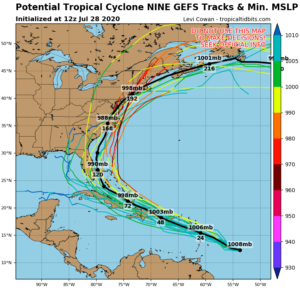
Computer forecast models suggest that the storm will move up the U.S. East Coast with time. However, that extended outlook can change as the system takes shape over the next 48 hours. While most guidance suggests the U.S. East Coast and Mid Atlantic could see direct impacts, a path into the Gulf of Mexico is still possible. As such, no one along the U.S. Gulf or East coasts should let their guard down ahead of this storm.